History | Maps | Photos | Neighborhood Highlights | Notable Residents | Building Survey | Public Events | Newspaper Articles
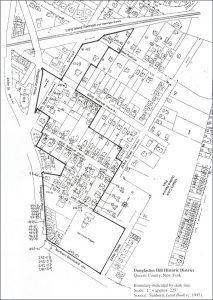
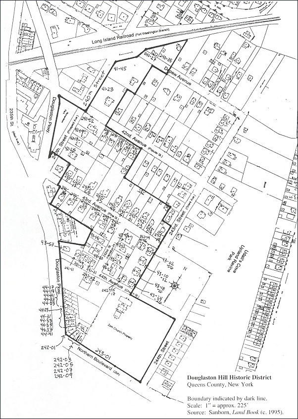
The landmarked Douglaston Hill Historic District is located in northeastern Queens County, New York, near the border with Nassau County. Roughly, the district is bounded on the north by the Long Island Railroad; on the south by Northern Boulevard, a major county thoroughfare; on the west by Douglaston Parkway, a main street in the immediate area; and on the east by Udall’s Cove Upland Ravine Park, a natural area.
The district’s boundaries follow the basic configuration of the street grid, encompassing the blocks of 44th Avenue, 43rd Avenue, the southeastern half of 42nd Avenue and the southeastern end of Depew Avenue — between Douglaston Parkway and 243rd Street (along the edge of Udall’s Cove).
Boundary Justification
The neighborhood of Douglaston Hill is bounded on the east and west by two prominent natural wetlands of northeastern Queens Alley Pond Park and Udall’s Cove Park. The neighborhood is bounded on the north and south by the Long Island Railroad (in place since 1867) and Northern Boulevard (a major Queens thoroughfare for more than a century). These boundaries reflect the natural and human development patterns of northeastern Queens.
Within that long-held neighborhood boundary, the Historic District boundary is drawn to reflect the natural and human development patterns in northeastern Queens. The District encompasses those features which best reflect the area’s historic development. The District fans out in a northwesterly direction from Zion Episcopal Church, with the northeast quadrant of the neighborhood omitted from the District. That quadrant comprises many houses built after the District’s period of significance (1900 to 1930), as well as a number of houses that are heavily altered. While there are some physical features within this area that reflect Douglaston Hill’s significance, as a whole, this quadrant does not retain the same level of integrity as the Historic District section.
Specifically, the district runs from the corner of 244th Street and Northern Boulevard west to Douglaston Parkway; north on Douglaston Parkway to approximately 62 feet (along property line of Lot 21, Block 8107) north of 44th Avenue; east approximately 166 feet (along the rear property lines of Lots 21 and 231 of Block 8107); north approximately 100 feet (along the rear property lines of Lots 214 and 212 of Block 8107); west approximately 288 feet (along the rear property lines of Lots 46, 43, 40, 38 of Block 8107); north approximately 116 feet (along the property line of Lot 38, Block 8107); west approximately 60 feet along 43rd Avenue; north approximately 100 feet (along the property line of Lot 81, Block 8106); east to Douglaston Parkway; north along the edge of the Catherine Turner Richardson Park; east to 240th Street; north across Depew Avenue to edge of Long Island Railroad cut; east approximately 270 feet (along rear property line of Lots 25 and 21, Block 8103).
History, Origins and Significance
The proposed Douglaston Hill Historic District, located in northeastern Queens (a borough of New York City) near the border with Nassau County, is significant in the area of community planning and development and as an example of a turn-of-the-century suburb. The district consists of substantial single-family homes, multi-family apartment buildings, commercial buildings, a small park and a church and cemetery. It is architecturally noteworthy for its many fine examples of late nineteenth and early twentieth century styles including Colonial Revival, Queen Anne, Shingle Style, Tudor Revival, Prairie Style and American Craftsman designs.
In its park-like setting, architectural expression and social history, Douglaston Hill is representative of the evolution of the commuter suburb. Within that context, the Hill, which developed over a period of eighty years, can be interpreted both as a precursor to the planned suburban enclaves of the late nineteenth and early twentieth centuries (such as the adjacent Douglas Manor and the renowned Forest Hills Gardens) and as evidence of the speculative suburban development which remade the borough of Queens in the 1920s and 1930s.
The transformation of Queens from colonial villages to estates and small farms to commuter suburbs is typical of American settlement patterns in many parts of the country. The dramatic spatial change that this pattern of growth brought about — and the parallel development of a quintessential American lifestyle — were due to several factors. Rapid advances in transportation, particularly the steam railroad in the first half of the nineteenth century, made long-distance commuting possible. New levels of personal wealth following the Civil War, coupled with the pervasive cultural values of mainstream Victorian society, gave rise to a middle class that embraced virtues of domesticity, home ownership and life in a sylvan setting.1 These values were made manifest in the commuter suburb, a distinct form of community building which places the single-family house in a non-urban setting, convenient to the city by rail.
By 1939 the Federal Writers’ Project New York City Guide had designated Queens the “borough of homes,” a result of some fifty years of intensive speculative, mostly suburban, housing development.2 This development had its roots in planned developments of the 1870s and was greatly accelerated by the consolidation of New York City in 1898 — specifically by the public transportation improvements, large-scale middle-class migration and public works it brought to the new Borough of Queens.3
Within the boundaries of Douglaston Hill today, this history of community planning and development, from the 1850s to the 1930s, can be read in the district’s topography, layout, architectural expression and historic street names. The boundaries of the proposed Historic District encompass that section of the Hill which retains a relatively high level of integrity of location, design, setting, materials, workmanship, feeling and association.
Regional Development
By the mid-1600s, several English and Dutch colonial towns had been established in what is now northeastern Queens. The settlers farmed and raised livestock in and around Mespat (Maspeth), founded in 1642, Vlissingen (Flushing), founded in 1643, and Jamaica, founded in 1650.4 Colonial settlement along the northeastern shore began near Alley Pond in 1647, and a decade later when, in 1656, the Dutch assigned to Thomas Hicks a peninsula then called “Little Madman’s Neck,” which encompassed much of present-day Douglaston. Hicks is best remembered for his “eviction” of the Matinecoc Indian tribe from its fishing grounds on Little Neck Bay in the 1660s.5
By 1683, when Queens County was established as one of ten English counties, these colonial settlements were thriving villages. The county was then divided into five “towns”: Newtown, Jamaica, Flushing, Hempstead, and Oyster Bay.6 The Alley Pond settlement (including present-day Douglaston lay within the town of Flushing. Farming was the primary use of the land, with a few large families the predominant property owners. The years prior to the Revolutionary War saw more estates built in the area, including the Cornelius Van Wyck House of 1735 (located within today’s Douglas Manor and a designated New York City Landmark).
Most residents of Queens were loyal to the British throughout the Revolution. Consequently, the county was under British occupation for seven years, serving as a major staging ground for British troops; and after the war, as a staging ground for the evacuation of loyalists. By the war’s end in 1783, the county’s once extensive tracts of primeval forest had been devastated and many farms pillaged by British soldiers.7
Recovery and growth were slow in the first half of the nineteenth century, but transportation improvements led the way for future settlements. Six turnpikes were built in the 1810s, improving farmers’ access to urban markets, and the Long Island Railroad began running from Brooklyn to Jamaica, Queens in 1836. The 1850s and 1860s saw large numbers of working class German and Irish immigrants settle in the industrial sections of western Queens; at the same time the “gold coast” of the north shore began to be a haven for the country homes of wealthy New Yorkers, along the coasts of Ravenswood, Flushing, Bayside and Douglaston, and into present-day Nassau County.
The Civil War catalyzed another wave of development and settlement in the 1860s and 1870s, when a number of large farms were transformed to development sites and whole villages were laid out. Richmond Hill (1869), Long Island City (1872), Bayside (1872) and South Flushing (1873) were all created in this way. In the decades leading up to the 1898 consolidation of the City of New York, most areas of Queens which were accessible were being developed.8
Two major public works were completed in the first decade after consolidation: the Queensborough Bridge opened in 1909; and the Pennsylvania Railroad completed tunnels under the East River in 1910. Rapid access for the masses brought increased industrialization and intensive housing development, and by 1930 the borough’s population had quadrupled and the assessed real estate value had multiplied sixfold.9
Origins of Douglaston Hill 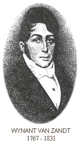
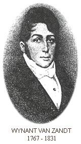
In 1813 the peninsula estate on Little Neck Bay passed to prominent New Yorker Wynant Van Zandt III. Van Zandt had been an Alderman of New York City and a Vestryman of Manhattan’s Trinity Church before retiring to Little Neck as a gentleman farmer. He built a large mansion in 1819 (which survives as the Douglaston Club, and is a designated New York City Landmark).10 When Van Zandt arrived at Little Neck, there existed a community of gentlemen farmers, small “truck” farmers, merchants, artisans and oystermen. Its center was the Alley Pond settlement, considered in local histories to be the birthplace of Bayside, Douglaston and Little Neck. The narrow roadway that ran along Alley Pond was the primary route from Flushing to points east; thus the first Flushing post office was located at the Alley in the 1820s. The post office, along with a mill (dating to the 1750s), a blacksmith shop and a general store (dating to 1821) became the village common — from which farm produce and wood were shipped to New York.11
Van Zandt took an active interest in the civic affairs of the community centered around Alley Pond. In 1824, he financed the construction of a causeway across the marsh, creating a more direct and efficient route to Flushing.12 His deepest impression on the Douglaston area was his bequest, made in 1829, of land upon which to build a church and funds with which to build it.
For some years, Van Zandt had driven to Christ Church at Cow Neck (now Manhasset, Long Island), where his brother-in-law served as Rector. At that Rector’s transfer out of the Cow Neck parish, Van Zandt conspired to build a church for Little Neck. More than twenty men pledged further funds, and less wealthy members of the community pledged their labor, including a local painter and blacksmith, along with farm boys who made shingles. Douglaston Station was dedicated in 1830 by Bishop William Henry Hobart of the Protestant Episcopal Church of New York. Bloodgood Haviland Cutter, known as the “Long Island Farmer Poet,” remembers the church construction as a young boy:
“When the church frame was completed, I remember a great preparation was made to raise the frame…A great many gathered and helped raise our Zion frame…In the evening we had a good old-time feast with great rejoicing for the success in getting up the frame without accident. That was kept up till late at night.”
Since its inception, Zion has served in the tradition of the 18th-century New England Meetinghouse, as a center of religious and social activity for a far-flung community of farmers. Land for Zion’s cemetery was donated in 1834 and again in 1885. (This original building was destroyed by fire in 1924 and rebuilt shortly thereafter.)13
A few years after the death of Wynant Van Zandt in 1831, the Van Zandt family sold its estate. The waterfront peninsula portion of the property (what was to become Douglas Manor) was sold to George Douglas, described in the deed of sale as a “Gentleman.”14 The portion to the south, encompassing what was to become Douglaston Hill, was sold in 1834 to Joseph DeForest. DeForest sold the hill property one year later to Cortland Van Beuren, who sold it in 1843 to local farmer Jeremiah Lambertson. Lambertson held the property intact until 1853, when he laid it out in lots in an urban grid and sold them at auction.
George Douglas held the peninsula property until 1862, when at his death, his son William P. Douglas inherited the estate. In the tradition of gentleman farmer, William was active in local affairs, at Zion Church, as well as in supporting community-wide improvements. During William’s tenure, up to the 1906 sale of his estate for subdivision, this rural village began its transformation to suburban enclave.
The transformation began with the subdivision and sale of the Lambertson property in 1853. While little is known of Lambertson, the nature of the sale indicates that he was likely banking on the coming railroad to ensure a successful land venture. The Flushing & Northside Railroad extended to the Village of Flushing in 1854, and as far as Great Neck, presently Nassau County, Long Island, in 1866.15
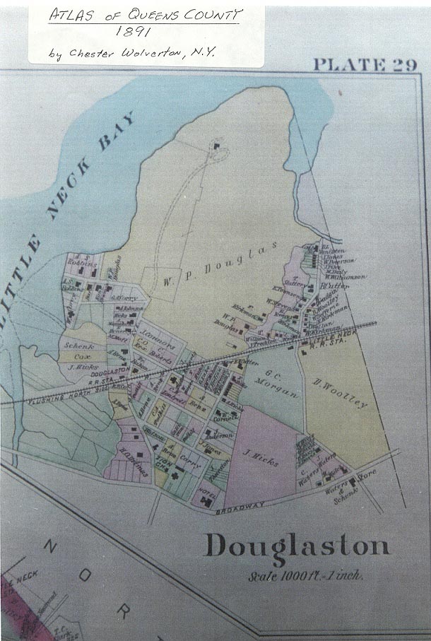
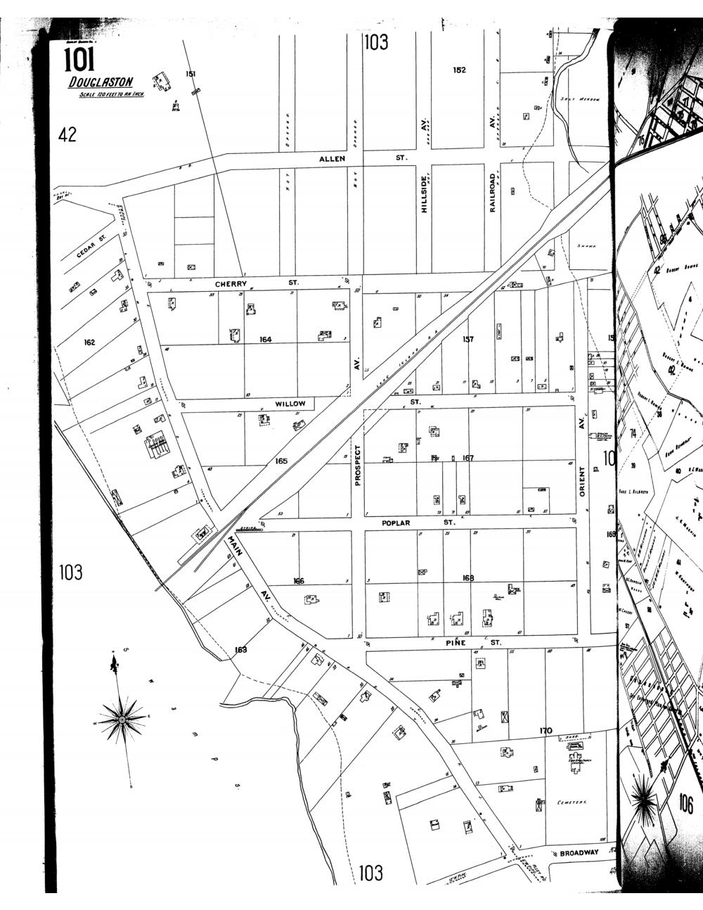
On February 15, 1853, the Flushing Journal reported that a party of 16 persons arriving by omnibus had purchased the farm of Jeremiah Lambertson, with the intent of building 16 country seats upon it. Property deed records show that title was transferred on July 23 and 27, 1853, from Lambertson to 18 buyers, with most buyers purchasing three and four lots each.16 These lots had been laid out in generous 200′ x 200′ lots, set amid a street grid within the natural boundaries of the Alley Pond and Udall’s Cove marshes. The streets were named for trees, e.g., Pine, Cherry, Poplar, Willow.17 No country seats were built however, and the land remained mostly vacant until the turn of the century.
The Suburban Development Context
Because the Douglaston Hill subdivision was one of the earliest in northeastern Queens (Woodside and Bayside, both earlier stops on the Flushing & Northside Railroad, were not laid out until 1867 and 1872 respectively) its fifty-year evolution from mapped lots to built form provides a window onto how the commuter suburb developed as a physical and psychological manifestation of American middle class values.
While Lambertson created a new locale with his subdivision, it is relatively clear that he did so as a speculator. Nevertheless, one important context for its development was the nascent movement among landscape artisans and architects to create naturalistic compositions of rural residential enclaves connected to the city by rail. The ideas of a new and distinct form of community planning had their origins in the garden city movement of England of the 1820s, wherein the characteristics of rural, domestically-centered preindustrial environments were consciously incorporated into new towns.
These ideas were becoming more widely known around the time of Lambertson’s sale.
It is widely held that their first expression in the United States was in the picturesque semi-rural cemeteries created in the 1830s. The popularity of these cemeteries with city dwellers turned them into parks and picnic grounds. Many early suburban residential projects incorporated design elements of the cemeteries, such as contrived naturalistic landscape and street names evoking natural features.18
By mid-century, a group of writers and designers had created a “cult of domesticity,” proclaiming the moral virtues of family, home ownership and semi-rural dwelling. Catherine Beecher’s widely read Treatise on Domestic Economy (1841), and Andrew Jackson Downing’s A Treatise on the Theory and Practice of Landscape Gardening (1841), were among the first books to offer house plans, and argue that gardens and home ownership were key to harmonious family life. Widely read, these books were instrumental in formulating the American domestic ideal.19 Consequently, they were influential in the development of the suburb, a phenomenon which architect and scholar Robert A. M. Stern has described as “…a complex embodiment of American aspirations deeply rooted in the national psyche.”20 By the 1850s, many of Downing’s principles were being expressed in the suburban developments created by his partner Calvert Vaux, architect Alexander Jackson Davis, and landscape designer Frederick Law Olmsted.
In 1853, Davis and developer Llewellyn Haskell created Llewellyn Park, New Jersey, the first American suburb. Twelve miles from Manhattan, it was a 350-acre development with a strip of common parkland, curving streets, a consistent architectural expression and a pastoral landscape. Llewellyn Park embodied the essence of what would become the characteristic suburb, but for the fact that it was several miles from a railroad station and thus impractical for all but the very wealthy.21
The creation of Riverside, Illinois — by developer E. E. Childs and designers Olmsted and Vaux in 1869 — brought the element of accessible transportation to bear on the suburban ideal. Childs’ notion that a rural retreat must be convenient and community-oriented resulted in the creation of a town center around the railroad station, establishing the basic premise of suburban enclaves. Riverside incorporated development stipulations to protect its character, especially to ensure “both the town’s appearance of affluent spaciousness and a general visual coherence by keeping landscaped areas primary.”22 These included stipulations on how a house could be sited, and a minimum lot size of 100′ x 200′.
No direct evidence links the subdivision of the Lambertson property in Queens to the emerging ideas about suburban living. Still, the development history and the physical environment in place today reflect period responses to Victorian design principles and social values — and the budding suburban ideal.
The Lambertson subdivision only slightly interrupted the existing village community’s organic growth. The Hill’s core development occurred some fifty years later, between 1900 and 1930. Douglaston Hill became a suburban enclave in form, but unlike many later suburban developments, which ensured homogeneity via restrictive covenants, Douglaston Hill maintained its mixed economic and racial composition for many years.
Community Development Context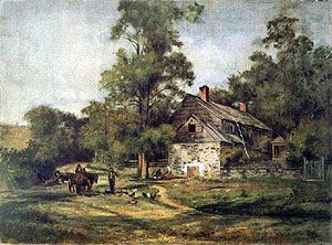
At the time of the 1853 subdivision, Zion Church was twenty years old. The village at Alley Pond was a shipping and trading hub, its general store providing an immense variety goods “from a needle to an anchor.” And the community of oystermen (many of whom were African American) was thriving, with more than a dozen sloops and schooners operating on Little Neck Bay at the foot of Old House Landing Road (now Little Neck Parkway).23
In 1867 the Flushing Railroad reached the Little Neck area, introducing an era of more rapid change. William Douglas donated a farm building from his estate to serve as the Douglaston Station; in exchange, he asked that the station and the village around it be called Douglaston.24 In 1887, Douglas and resident subscribers funded a Queen Anne-style depot building and landscaping at the new Douglaston station. Popular postmaster and gardener Albert Benz directed the landscaping project.25
The arrival of the railroad greatly reduced time to the city, but the trip still required taking a ferry from Long Island City, Queens to Manhattan. Douglaston remained relatively isolated, slowly attracting new residents. In April 1887, just prior to the Hill’s key period of growth, the Flushing Journal reported on the community’s idyllic setting: “Possessing all of the requisite features which tend to make a place of sojourn acceptable, Douglaston, indeed, is the elysium of restfulness and peace. From the old curbed wells that can be found in the yards of most of the farm houses to the stately trees that line the drives leading to the same — everything smacks of rural life in its most pleasing form.”26
Late nineteenth-century newspaper reports of activities at Zion Church and other civic affairs reveal the gradual introduction of newcomers and new ways of life into that “elysium of restfulness and peace.” The death in 1887 of Zion’s Rector Rev. Henry M. Beare marked the end of an era. Having served the parish for forty-five years, Rev. Beare was “widely known throughout the state, and in his own parish he was almost worshipped by his flock.”27 He was one of only a few Little Neck residents known beyond the immediate community. “Long Island Farmer Poet” Bloodgood Cutter, one of Little Neck’s more picturesque citizens, was another — best known as a friend and travel companion of Mark Twain’s.28 By the time of Cutter’s death in 1906, new residents — both permanent and seasonal — were introducing a more prominent, middle class commuter population into this secluded hamlet community.
In the first decade of the twentieth century, frequent reports by the Flushing newspapers record the comings and goings of seasonal residents as well as house construction for permanent newcomers. These included a bank clerk, a cigar maker, a well-known dentist (whose family resided in Douglaston for two “seasons” before purchasing property), an active suffragette, a composer of popular song, the general manager of Pittsburgh Steel interests in New York, and a prominent Manhattan physician.29
Census records from 1900, 1910 and 1920 show a range of occupational categories for Douglaston Hill — from professions such as chemist, lawyer, teacher, banker, builder, jeweler, merchant, post office and railroad stationmaster to laborers such as blacksmith, mason, shoemaker, domestic, factory worker and laundress. Several families of African American oystermen are listed in these Census records.
This community of black oystermen had existed in Little Neck, some as property owners, since the 1850s. While their homes were located outside the Lambertson subdivision (most along Orient Avenue near the dock at Old House Landing Road), they contributed to community life. Upon the death of oysterman Jacob Treadwell (1833-1904), the Flushing Daily Times reported “He was a well known character in and about Douglaston, where he has been a life long resident” This community’s church on Orient Avenue, St. Peter’s African Methodist Episcopal Church, was active for over 100 years: founded in 1872, the church building on Orient Avenue held services until the late 1980s. The Hill’s major period of development coincided with the oystermen’s decline, following the 1909 condemnation of polluted Little Neck oyster beds.30 While their numbers substantially decreased in the early years of the twentieth century, several ancestors resided in Douglaston for many more years.
The early years of the Hill’s development were led by a small group of men, whose actions as realtors, builders and home owners shaped the community both physically and socially. William J. Hamilton, Denis O’Leary, W. R. Griffiths and John Stuart were among the first to begin building within the Hill area, and they were prominent residents during the first decades of the twentieth century.
Between 1890 and 1908 six lots were developed by William and Josephine Hamilton, including their own at 240-35 43rd Avenue (Block 8106/Lot 69). Their undertaking began at the turn of the century, when they bought and sold two of the Hill’s original 200′ x 200′ lots (which had been held by only two owners since 1853). By 1908 William J. Hamilton was recorded as owner and architect/builder for four houses, and was recorded as owner of two others. In his brother’s obituary in 1907, Hamilton was described as the “well-known builder of Douglaston.”31
Like Hamilton, John Stuart was the architect/builder of record for at least three houses during the Hill’s early years, and his building plans were noted in the local newspapers.32 Both Hamilton and Stuart are memorialized by street names in the neighborhood — Stuart Lane and Hamilton Place, and Stuart’s descendants have been active builders/developers into the present day, including current renovation projects currently underway in the Hill.
In 1898 and 1901 Mrs. William J. Hamilton sold two adjacent 200′ x 200′ lots (numbers 94 and 89, respectively) to Mrs. Denis O’Leary.33 The O’Leary’s ultimately shared Lot 94 with the Hamiltons — nearly identical houses were built in 1901 on the equally divided lot. The O’Leary’s subdivided and developed Lot 89, building four houses on four 50′ x 200′ lots in 1903. Denis and Eleanor O’Leary lived in Douglaston Hill from c. 1901 to c. 1943 (Denis O’Leary died in 1943). Their two daughters remained in Douglaston Hill through the 1950s, living in separate houses across 43rd Avenue from their childhood home.
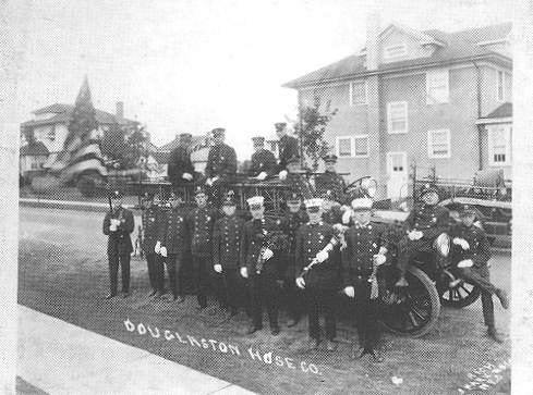
Denis O’Leary was typical of an early suburban commuter. A prominent attorney and politician, he was active in civic affairs within and outside Douglaston Hill. He served as Assistant Corporation Counsel for New York City, Public Works Commissioner, Queens County District Attorney and U.S. Congressman. Locally, he was a founding officer of the Douglaston Hose Company No. 1, officiating at many of its social functions at Zion Parish Hall, sometimes in the company of New York City Mayor Jimmy Walker. And he was active in numerous charitable and fraternal organizations, including the Shinnecock Democratic Club of Flushing (President), the Flushing Council (President), the Catholic Benevolent Legion, and Holy Name Society of Sacred Heart Church, among others. (Denis O’Leary may have been part of the founding meetings of St. Anastasia Roman Catholic Church, at the home of Otillie and Adolph Helmus at 240-16 43rd Avenue (then Pine Street) in 1915. Masses, baptisms and church meetings were held in this home while the congregation was being officially formed.)
Similarly, attorney W. R. Griffiths was typical of the new resident. Frequently cited by the newspapers as the attorney for real estate transactions within the Douglaston Hill district, Griffiths was committed to civic affairs in and beyond Douglaston. He was an officer of local Republican clubs, such as the Roosevelt & Fairbanks Campaign Club, and devoted many years to the public works of the United Civic Associations of the Borough of Queens. He was a vestryman at Zion, and led several community improvements such as maintenance of the salt meadows and ornamental tree plantings near the train station.34
The development of a community connected to the city at large is also illustrated in the founding and continuity of the Douglaston Art League in 1930, and still active today (now known as the National Art League, located at 44-21 Douglaston Parkway). The League was founded by Mrs. Arthur Sullivan and Miss Helen Chase – sisters and daughters of New York painter William Merritt Chase – along with other residents and north shore artists who were “interested in arousing amore general appreciation of art in the community and in providing a means for practical development of individual talents.”35 Architect Aubrey Grantham (Zion Episcopal Church) was among the founders. The League’s early exhibits and classes were held in the backroom of a beauty shop and its second show was exhibited in the Parish Hall of Zion Church.
The period from 1900 to 1930 was one of enormous growth for the borough of Queens, and for Douglaston. Writing in 1936, Zion’s Rev. Lester Leake Riley remarked on the results of that growth: “By 1910 the old farms are disappearing, the old landmarks fade away, or are hidden behind these Tudor makeshift fronts, the mart of our busy shops and stores. By 1920 our village assumes an air of suburban dignity.”36 Approximately 2,000 people lived in Douglaston-Little Neck in 1920. Just ten years later the area’s population was 8,000, and Douglaston Hill was fully developed.37
Maps
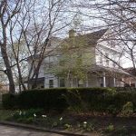
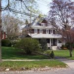
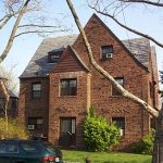
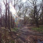
A collection of photographs from around the neighborhood
taken in early spring 2001

Neighborhood Highlights
Zion Church
Original Zion Church
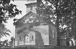
The above picture shows how the original Zion Episcopal Church, Parish of Little Neck, looked before it was destroyed by fire on Christmas Eve of 1924. The church, built in 1830, was erected at the instigation of Wynant Van Zandt, who donated the property and funds for the building. The project was a community affair, since many of the residents contributed time and materials for the building. The edifice was constructed of wood from trees cut on the Van Zandt estate. A sawmill was brought to the scene to prepare the lumber and everybody helped with the work. The original church had no middle aisle and the pews were made of pine. Dedication ceremonies were held on June 17, 1830.
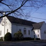
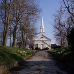
Zion Episcopal Church
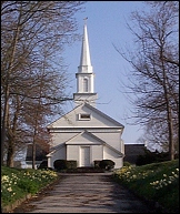 “Shortly after the disastrous fire of 1924, the church was rebuilt, using a modern design. More rooms were added and the church itself was somewhat larger. The new church was ready for formal opening on December 25, 1925. In 1929, fire broke out again and destroyed the chancel, sacristy and the choir rooms. When rebuilt, the sacristy was enlarged to provide a study for the rector. The White Church on the Hill — as it was called — is shown above. A portion of the newer section of the churchyard may be seen in the foreground. The original graveyard area is west of the church buildings.”
Detailed History
(From a booklet published by Zion Church)
In the year 1813, the land on which Zion Church is situated – and the surrounding area – was in the possession of the Van Wyck family. This year saw one of the last mail deliveries by stagecoach at the Little Neck Post Office at Alley Pond, and that year Wyant Van Zandt, as prosperous city merchant and alderman, acquired 120 acres along the shores of Little Neck Bay and settled down to the life of a farmer with his sons to help him. The family lived in the old Colonial house on West Drive, Douglaston, now owned by the Larson family. Here they lived until 1819 when the “mansion” now occupied by the Douglaston Club supplanted the Van Wyck house and became the Manor house of the old farm. Mistress Van Zandt was the mother of seven sons and four daughters, and the new house with its big square rooms must have been none too large.
 Wyant Van Zandt and his wife Maria were good neighbors in this community, gaining the friendship of other farmers who cooperated with him in breaking through the meadow which now crosses Northern Boulevard, saving the long way around Alley Pond and shortening market trips to the city. Much later, in the process of widening and straightening the Boulevard, previously called Broadway, the site of the Matinicoc Indians’ last battle and the graves of the slain were cut into, and the Indian remains were transferred to Zion Churchyard.
The Van Zandt family were faithful in their religious duties and drove to Christ Church, Cow Neck, Manhasset, where Wyant Van Zandt was a communicant, to attend the services conducted by the Reverend Eli Wheeler, brother of Maria. Wyant Van Zandt also established regular Sunday worship in the East parlor of his home and later built an octagonal structure with two wings to serve as a chapel.
A Church for Little Neck
When, after a few years, Mr. Wheeler took the rectorship of a church in Shrewsbury, New Jersey, Mr. Van Zandt broached the subject of a church for Little Neck, as this community was then called. Finally, he decided with the help of his neighbors to build the church himself. So his chief gift to this community was the donation of land and funds for the building of Zion Episcopal Church and Sunday School. All of the following signed a “document” pledging funds for the building: Wyant Van Zandt, Roe Haviland, Philip Allen, Eliza Allen, Richard Allen, Jeffrey Hicks, Joseph L. Hewlett, Jerome Van Nostrand, William Haviland, Thomas Hicks, Henry S. Cornell, Charles Peters, Richard Place, Thomas Foster, Jeremiah Valentine, Robert Van Zandt, Edward Van Zandt, and Washington Van Zandt.
The New York architect Upjohn furnished the plans; Stephen Cornell was the builder, and Will Buhrman of Alley Road, the painter. All of the materials which went into its construction, except the glass for the windows, came from local sources. What the people could not give in cash they gave in labor and materials. The smith at the Alley hammered out the hand-wrought hardware and nails; Van Zandt and his neighbors cut their finest trees for beams and rafters, and a sawmill was brought to the scene to prepare the lumber. Even the boys were allowed the task of making the shingles for the bell tower.
At a great neighborhood raising the cornerstone was laid in 1829. The building was completed and opened for worship according to the usages of the Protestant Episcopal Church on June 17, 1830. Records recounting the raising of the church and its dedication include the names of nearly every family in the vicinity and the supper table set out on the grounds to celebrate its completion stretched half a block down the road.
Consecration
Bishop William Henry Hobert of the Protestant Episcopal Church of New York formally consecrated the brown church with the square tower and the cemetery on July 30, 1830. And they called it Zion, the Hebrew word “Tsiyon” meaning hill, also “Heavenly.” Perhaps they were thinking of Psalm 48 “Beautiful for situation is mount Zion” and certainly so were the church and its grounds.
First Rector
The Reverend Eli Wheeler was brought to Zion Church as its first rector and he served until 1837. A description of the congregation from an observer of the time follows: “I looked over the congregation and observed them carefully as I came with them out of the house at the close of the service, and saw that they were rural and simple folk; not rude, but unfamiliar with what is called the world; and under the wise teachings of their noble pastor and preacher they were being trained intelligently for the true enjoyment of religion and for the glory beyond the skies. Happy people!”
The original church building had neither chancel nor middle aisle. The elevated pulpit stood against the wall before the people, and below it on the ground floor, surrounded by a railing, was the plain “Communion Table” or Holy Table as it is called in the Prayer Book. It was the custom of the minister to wear the old-fashioned full-flowing surplice over his clothes together with a black stole, which he would change just before the sermon and appear in the pulpit gowned in a black robe with white hands at his collar front.
Wyant Van Zandt died in 1831 at the age of 64. His body was interred in the family vault beneath the church, its only monument being the marble tablet to his memory upon the church wall above the vault. Six other adults and four children were also interred in the vault. The Parish has records on each, and their remains were lowered below the new floor during the 1965 consecration.
Although Henry Van Zandt continued to live on a part of the farm after the death of his father, the major portion of the land was purchased in 1835 by George Douglass, “a Scot of quiet tastes and great wealth,” and its name changed to that of the newcomer, “Point Douglass.” The Douglass family were active members of Zion Church and contributed the chancel of the church, stained glass windows, and an organ in 1863-64.
In 1842, the Reverend Henry Marvin Beare came to Zion Church as its Rector. He was loved and respected not only by his parishioners, but also by all the community. An incident of embarrassment during his tenure was his discovery that the coachman, after driving the rector on his parish visits, had returned at night to these homes and robbed them of their silver and other valuables. The coachman hid the stolen goods in the belfry of the church, where the Reverend Beare discovered them quite by accident. The shock to him was very great, though naturally no one held the rector or the church responsible for the thefts. Dr. Beare’s teaching was always based on the Book of Common Prayer and it is said that he distributed hundreds of copies of it as gifts.
Henry Bear died January 9, 1887, ending forty-five years of loving and faithful service to his parish and the community. The bronze tablet on the east wall of the church, presented in January of 1894 as the gift of the people, is to his memory.
Several rectors followed the Reverend Beare, and in 1902 the Reverend Albert Bentley came to Zion. His wife, Nellie, was organist and choir director. Many choir concerts, Gilbert and Sullivan operettas, and other plays were given under the direction of Mrs. Bentley.
Parish House
On October 3, 1896, the cornerstone was laid for the Parish House. The building was dedicated on May 23, 1897, and became the social center of the parish and the entire community. Bowling alleys had been built in the basement, monthly socials were held as well as annual fairs, strawberry festivals, church suppers, and other events. The rector, wardens, and vestry permitted outside organizations to use the Parish House free of charge, and there was always some kind of activity, even as there is today.
Since the neighborhood of Little Neck was growing fast, it was decided to call the new station “Douglaston.” So, as part of Douglaston, Zion stood, in the simple design of a country wayside church with its square bell tower, for a period of 94 years.
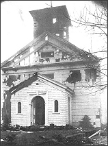
1924 Fire and Re-Building
An outstanding event at Zion was the Children’s Christmas Festival. In the year 1924 the children were all safely home and tucked in their beds after such an occasion when fire broke out in the old building. Every effort was made to check the flames, but they had made such devastating headway before the fire was discovered that is was of no avail.
The rector at the time was the Reverend Robert Black. Through the courageous efforts of Dr. Black and his wife, items of great historical value, the cross, the communion set, collection plates and candlesticks were rescued. The altar cloths and drapes were lost and the organ was ruined; the bell which had sounded for four generations fell from the blazing belfry and burst into fragments. The interior of the Parish House, recently rehabilitated, became a shambles.
The burning of Zion Church shocked the entire community. Expressions of sympathy came from all sides and promises of support from near and far without regard to creed or denomination. Community Church threw open its doors and its pastor, the Reverend Eugene Flipse, placed every facility at the service of Zion. The Christmas Holy Communion Service was held in the new Community Church building.
Steps were taken at once to rebuild, and Dr. Black called a meeting at which Aubrey G. Grantham was present. As originally built, the church was slightly short for its breadth. A longer nave, barrell-vaulted ceiling, and the possibility of a spire were debated. Mr. Grantham became the sole architect and the result was a dignified, restrained and scholarly performance, a restoration made perfect with additions which are part of the proper design of the Colonial period. The Architectural Record of March, 1927, showed the church as an illustration of simplicity and restraint in design.
The Parish House, rebuilt at the same time, was kept to the Colonial design and shares the dignity and simplicity of the church. The auditorium sets 150 persons, and is provided with stage equipment for theatricals. There was a good kitchen, and at the time the downstairs included a Guild Room and Boys Club Room. The builder was Samuel Lindbloom, also of the parish.
The following is a description of the church, open and ready for worship on Christmas, 1925: “The old floor and beams remained at the time of the rebuilding, except for the area destroyed by the crash of the bell; and of course the bell was rebuilt. The Colonial interior of the church has beauty of its own. No “dim” religious atmosphere was intended. Daylight pours through the open panes of glass, tinged here and there with a lavender hue. The sixteen-over-sixteen windows are beautifully proportioned, and the church is bright and full of quiet dignity and cheer. The pews are Colonial design, and comfortable.
“The altar rail encloses the completed apse, and the rounding curve of the wall is pierced at the top by three clear glass circular windows. Before the middle window rises a white cross that surrounds a frame of simple design serving as the reredos for the altar, and into its frame is a rich damask cloth of red and gold. With this lovely background the re-table of the altar supports on either side the ornate brass cross, the two eucharistic candlesticks and the flower vases. Just beneath, emblazoned in gold, are the words COME UNTO ME.
“The altar is in keeping with the church and offers no ornament but a white painted wood-carved medallion on its front of the pelican feeding her life’s blood to her brood, and symbolizes our Lord feeding the faithful with the Blessed Sacrament.
“On one side of the Sanctuary is the Bishop’s Chair; opposite, the clergy chair. The choir stalls are arranged in the chancel, and the organ chamber is to one side of the choir. The Baptismal Font is to the front of the chancel. The Lectern, or reading desk, which supports the Holy Bible, is wrought in brass in the form of the conventional eagle. The pulpit is of brass and wood, and beside the pulpit stands the flag, symbol of the Soul of America. Simple Colonial candelabra serve for the electrically-lit chandeliers.”
Fire broke out again in 1929 and destroyed the chancel, sacristy and the choir rooms. In rebuilding, the sacristy was enlarged to provide a study for the rector.
Several years later an attempt was made to introduce into the church pseudo-Gothic or Medieval features which would have required a complete alteration of the existing structure. A majority of the parishioners felt this would produce a synthetic atmosphere of ritual, foreign in thought and infinitely removed from the faith and spirit of the original founders. Strong protest blocked such a move and the simple dignity of the Protestant Episcopal Parish Church endures.
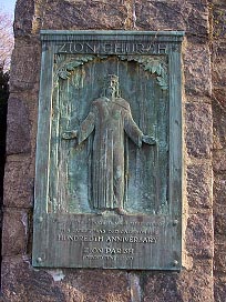
Later additions to the church include the bronze plaque at the church gate, inscribed “Out of the Woods My Master Came,” which was a feature of the centennial celebration in June, 1930. The carving on the same theme, inset behind the altar, is believed to have been created by the Norwegian sculptor, Tryglive Hammer. The frontal of Coronation Tapestry was given to the church by the Altar Guild at the time the altar step was removed.
The three clear glass circular windows have been replaced by stained glass as a memorial to Mrs. Theresa Gabler, and were installed during the tenure of the Reverend Marland W. Zimmerman, who served as rector from 1944-48.
The Credence Table at the east of the Altar supports the silver cruets, a gift of the Woman’s Guild, and there is another flag now to the west of the Chancel, the Church Flag, the red cross on a white field being the oldest Christian symbol.
At the south end of the church the balcony front was altered in 1959 to accommodate a new Moeller organ. This fine instrument was given as a memorial to Elizabeth Vanston Morgan, long-time resident of Douglaston and a member of the Altar Guild. The choir stalls were moved from the Chancel to the balcony at this time, happily yielding an unobstructed view of the curved sweep of the chancel wall and altar.
In the vestibule of the church is a tablet inscribed with the names of several parishioners who, in 1950, gave the tower bells now in use.
In the unusual winter of 1994 handicap access to the church was achieved by installing a three-station elevator on the east side of the building; entry is a ground-level vestibule, with stops on the main floor and in the undercroft. During construction of the lift it was discovered that a new flue was needed in the chimney and near-record snows of that year created problems for workers and parishioners. Later in the spring the altar was brought closer to the congregation by removing one step in the chancel and moving the altar rail to pew-level.
Undercroft
On September 11, 1964, during of the Reverend Canon Everett J. Downes; an ambitious program for the preservation and expansion of our facilities was started. It was found necessary to replace some of the old timbers found under the church, left from the original 1830 building, and it was decided to dig out under the present church and put in a full basement.
The Parish Co-chairmen of the project were William H. Borst and William H. Williamson, Jr.; the architect was Guercino Salerni of Long Island City, and the builder was W. Frank Wilkinson of College Point. The ten new rooms with space for classrooms, choir practice, robing accommodations for the choirs and acolytes, and a spacious library, are ‘bright and commodious, and can be reached from either the back or front of the church by stairways. New furniture was provided for the rooms as gifts or memorials from parishioners. The office on the first floor was greatly enlarged at this time.
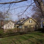
Rectory
Before the present rectory was built, Dr. Beare occupied a residence which stood on the south side of Northern Boulevard and was given to the rector, rent-free, by Mr. William F. Douglass, and, no doubt, his father. At a meeting of the Vestry on April 23, 1989, the rector reported that the late George Hewlett had in his will bequeathed $1,000 to the church, the interest to be given annually to the rector, or, in the event that a parsonage was to be built, the entire amount to be appropriated to that project.
In 1889 the Minister-in-Charge, the young Reverend William S. Barrows, inaugurated the campaign for building the Beare Memorial Rectory on the two-and-one-half acres of land facing Douglaston Parkway, purchased for $250 one hundred years ago. A second $1,000 was given by the Hon. John A. King and about $2,000 from the congregation, so that forty-one years after buying the land for that purpose sufficient money was at last on hand to build, and the rectory was completed in 1890. Edgar Lewis Sanford was the first rector to occupy it. The name of the man in whose memory it was built was intended to be inscribed on the stained-glass shield at the landing of the stairs to the second floor. The sexton’s cottage, later removed, was built in 1861 on part of the ground adjoining the churchyard.
Churchyard
An acre of land to the east and west of the church was added in 1834 by a gift from Joseph de Forest, and was to be used as a cemetery. In 1885 Bloodgood H. Cutter deeded an additional two acres to the east of the church in memory of his wife. Burial plots were first laid out on the west side and here can be found the names of most of the original “document” contributors. The whole of the grounds now comprised nearly seven acres.
In 1957 a city block across from the rear of the Parish House was purchased, and an acre and a half of asphalt-paved land now serves
as a parking lot.
The Churchyard is on high ground and has no atmosphere of death and corruption which characterizes an old neglected spot. The grounds are attended and the “winds of heaven” blow through the trees.
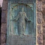
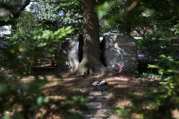
A memorial to the Matinicoc Indians was dedicated on Sunday, November 1,1931 marking the closure of their ancestral burial grounds on Northern Boulevard and Jesse Court in Little Neck. The site of the re interring is marked with a tribal symbol, a tree growing from a split rock.
Surely in these cemetery grounds can be felt the spirit of our well-known hymn,
The mystic sweet communion
With those whose rest is won.
In the Easter, 1973, Zion monthly Bulletin, a piece entitled “A Churchyard Stroll” appeared from which the following is quoted: “Helen Drewes, landscape architect and the Douglaston Garden Club’s tree expert has listed Zion’s outstanding trees:
“West of the driveway, yellowwoods, a ginko, large old Japanese maples, and a cultivated sweet cherry which is the largest in the vicinity and was obviously planted by early settlers.
“East of the circling driveway, a white ash, identifiable by diamond-shaped markings of the bark; another white ash but in poor condition on the west side of the driveway; a Chinese elm southeast of the main entrance, its small thumb-sized leaves giving it a feathery effect; several black locusts set back from and along the main drive.
“Along the ‘within-cemetery’ driveway, on the left before the bend, a hackberry tree, sometimes known as witch’s broom; Sophora, or pagoda tree – when older it has sweet smelling white blossoms wisteria-like in shape. On the right, after the bend, two Kentucky coffee trees, specimens and very old. Their name is derived from the fact that early Kentucky pioneers used the beans in place of unprocurable coffee.
“Among trees planted as memorials in recent years, enhancing the pleasing prospects of a Churchyard stroll, are a Japanese maple at Lawrence Harvey’s grave, a red hawthorn given by the Garden Club in loving memory of Edith King, and a pink dogwood to scatter its petals over eleven-year old David Scanlan, which not long afterwards sheltered his mother and father as well�”
A dogwood was placed near the Northern Boulevard wall and west of the driveway in 1989 by the Douglaston Garden Club in memory of Catharine Turner Richardson.
Churchyard Tour
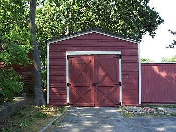
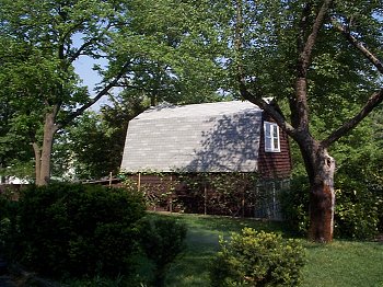
In 1995 a tour of the churchyard was developed beginning at the large stone “Cutter” cross just west of the building. Here are the weathered markers of families who buried loved ones following the 1830 dedication: Haviland, Allen, Cornell, Hicks, Lawrence. Just south of here is a stone marked “Mary Buhrman.” Between the stone and the white barn is the grave of Benjamin Lowerre. He purchased a general store and grist mill from the descendants of the Foster family, who had settled Allen Creek in 1637. Mary Lowerre married William C. Buhrman, whose name was associated with the store and mill in later years. The Alley was important because, before the road crossing the Creek and later named Northern Boulevard was built, the only route east and west went through the Alley just south of Alley Pond.
Between the “Caroline Bissell” cross and the barn is the Edwin Lawrence stone. This family owned burial plots on the east and west sides of the early churchyard, and they owned the section that was later developed as Marathon Park.
Farther south are several plots marked by low railings: the first belongs to Albert S. Griffin, an early Douglaston resident who traveled abroad and has been credited with importing seedlings of a variety of exotic trees such as the weeping beach at the Douglaston train station. John Bennem and his son Charles were for many years the Little Neck village blacksmiths who operated a shop on Little Neck Parkway just south of where the Chase Bank now stands. The next plot is Henry Benjamin Cornell, a life-long member of Zion. The last railed plot is the Schenk-Hicks families. Benjamin Schenk was a partner of Schenk and Van Nostrand, who operated the General Store in a white wooden frame building on the current site of the Chase bank. Mrs. Schenk’s father, John Hicks, owned several farms in the area between where the Long Island Expressway and the Grand Central Parkway currently lie.
Across the driveway and south of the “Cornell” bench is the plot of Alfred P. Wright, a wheelwright in Little Neck. The plot also contains a poignant stone for a daughter who died at the age of twelve, as well as an unusual cast-iron grave marker.
Closer to Northern Boulevard is the Hutton family plot, featuring another Victorian cast-iron marker. Behind the “Cornell” bench is one of the Hicks family plots.
The large “Bryce Rea” stone near Northern Boulevard is part of a more recently developed section containing the family plots of many local merchants: John Gabler, Bryce Rea, Doyle Shaffer, and others. From here on a clear day the towers of lower Manhattan can be seen to the west.
In the midst of a grove of cedars is the marker for John Gibson who served as Sexton for Zion Church for many years. To the left is the marker of Charles Hallberg, who along with Donald Kirkpatrick moved their families to Douglaston when Queens College was founded in 1938. They were two of the original twenty-eight professors of the college. The Kirkpatrick stone lies flush with the ground near the tall pine tree.
The Matinecoc graves, to the north near 44th Avenue, are described elsewhere.
Toward the church from here is the “Mott” marker. This is the second oldest portion of the churchyard. Members of the Mott family lived in Douglaston since before the Revolutionary War. To the left is a marker for the Van Nostrand family, also long-time residents of the area.
Memorial Fund
The Memorial Fund was created in 1965 to give scope and direction for gifts to the church. There have been many gifts over the years, and, in addition to those mentioned in earlier parts of this history, are the following:
The Litany Desk (prie-dieu), designed in appropriate Colonial style by Aubry Granthan, was presented to Zion Parish by Mr. and Mrs. William Allen. When litanies are said, the desk is placed at the head of the aisle, to signify that prayer and the leading of prayer are rights of the people. The rector comes down among the congregation and prays with them.
The Altar has a plaque affixed to it which reads: “This Altar, set apart to God’s honor and Worship at the solemn consecration of Zion Church, December 25, 1925. The loving gift of Mary Helmus.”
The pulpit was given by Mrs. Mary Helmus in memory of her husband, Adolph, who died in November, 1920. The chalice and paten now in use were given anonymously in Lent, 1946.
A chair, used by the Bishop when visiting the church, was given as a memorial to Mary Edith King by the Woman’s Guild in 1970.
In 1972 Richard Jundt hand-fashioned a four and one-half foot high cross from a railroad tie: he sanded it to a fine finish and applied many coats of white lacquer. The aumbry, or tabernacle, was given in the same year as an altar centerpiece by Marie and Charles Tuttle in memory of Mrs. Tuttle’s parents, August H. and Emma N. Former.
In 1973 the Jacobean tapestry front, called a “carpet of silk,” was donated by the Altar Guild. The chancel furniture was given in May of 1977 as a memorial to Canon Everett Downes. In 1978 an oriental prayer rug was given for use in front of the altar, again by Marie and Charles Tuttle in memory of Mrs. Tuttle’s parents. Mabel Carlander of Deer Isle, Maine, hand-hooked the rug, choosing the pattern and colors to harmonize with the church carpeting. Helen and Marion Gunning added the fringe.
The Vestry purchased a thirteen-ounce gold-lined chalice for festive occasions, using the Sorenson Memorial Funds as the family requested, in December, 1975, in memory of Charles M. Sorenson.
White Eucharistic vestments for use at the great festivals in the Church Year were given to the Parish in October, 1975. The Chasuble is the gift of the Altar Guild, and the Dalmatic and Tunicle for the sacred ministers is the gift of Mrs. Donald Fenn in loving memory of her husband.
St. Catherine’s Guild secured, in October, 1975, as a memorial to members Mrs. Louise Fasick and Miss Rose Stokes, a Coat of Arms of the Diocese in gilt and full heraldic colors by the artist Robert Robbins. The piece is installed on the choir gallery wall, and is also the gift of family and friends.
The symbol of the Risen Christ once affixed to a white cross above the altar was a memorial given by the Reverend Douglas A. Campbell on Easter Sunday, 1975, for his grandparents.
The church railings were given by Dorothy Cobleigh in 1988 in memory of here mother, Nell Gressitt Cobb. The 1982 Hymnals were given in 1986 by Marguerite Kirkpatrick as a memorial to her husband Donald Kirkpatrick.
The churchyard illumination and restoration of the lamps at the foot of the driveway were given in 1988 by the Vestry as a memorial for Antoinette (Toni) Hicks, longtime parishioner and devoted Douglaston resident.
On June 16, 1991, a white funeral pall was dedicated by Canon Cayless; the pall, with the Coronation Pattern design, and a lining of gold satin was given by the Zion Church Altar Guild and was partially funded by memorials for the Reverend Rex Burrell, rector of Zion Church 1970-86.
In 1996, the fence along Douglaston Parkway was improved and a garden at the corner of 44th Avenue was created in memory of Emil Brock.
Early Parishioners
A few words about some of the early workers for Zion. Mr. Henry S. Cornell, one of the eighteen signers of the document of 1829, had a large family. His sons, Archibald, Benjamin, and Henry all served as vestrymen. His son Augustine was the first young man from Zion to enter the ministry. His first church was the Episcopal Church in Nyack, New York, where he remained rector until his death at the age of seventy-four. This branch of the Cornell family has been active in Zion since 1830 and was represented by Alice Huestis, Clara Allen, Edna Randel Schulz, and Ruth Allen.
When Benjamin P. Allen died, Bloodgood Cutter, “The Farmer Post of Long Island,” wrote:
No more at church on Sunday meet,
No more will we each other greet,
Vestry meetings he’ll no more attend,
No more meet as friend to friend.
Mr. Cutter served on the Vestry for many years. At his death, most of his extensive library was given to Zion, including many books by Mark Twain. Cutter and Twain had traveled together extensively, and it is one of their trips to the Orient that prompted the writing of “Innocents Abroad.” Unhappily, this library was destroyed in the fire of 1924.
Dr. Edward Trudeau was a Vestryman for two years and was married to the Reverend Beare’s daughter Charlotte. He became ill of tuberculosis in 1872 and moved to the Adirondacks to dies in a place he loved. Surprised to find his health greatly improved after the first winter, he decided to stay on, making Saranac Lake his home for the forty remaining years of his life. He built Trudeau Sanitorium for the treatment of tuberculosis, and out of his own experience developed a method of treatment which was to have wide influence in the arresting of that disease.
Robert Louis Stevenson spent the years 1887-1888 at Saranac Lake as a patient of Dr. Trudeau and wrote some of his finest essays there. The Trudeau School of Tuberculosis grew out of the Saranac Laboratory and the memorial Foundation established after Dr. Trudeau’s death.
Mr. William Buhrman ran the general store at Alley Pond in 1828. The store served the neighborhood for nearly a hundred years, and it was in this store that the first Post Office of Flushing Township was established. Mail was brought by stagecoach, post rider, and boat. Mr. Buhrman and his son William gave generously to Zion.
Lewis Cornell from Little Neck, the only Revolutionary soldier buried at Zion, joined the militia and served under Colonel Humphrey in the Fifth Regiment of Dutchess County. He returned home to become active in civic affairs, and in 1798 was chairman of the Town Meeting in Flushing which petitioned the repeal of the Alien and Sedition Acts. He died in 1836 and was buried in the Cornell homestead cemetery. When Horace Harding Boulevard was widened all the remains from this cemetery were interred at Zion.
Civil War veterans buried at Zion are C. A. Bissel, William Pudney, W. H. Doremmus, W. H. Brower, John Cutter, W. Thurston, W. E. Cornell, John Starkins, Albert Griffin, Theodore Lambertson, Joseph Starkins, Horace Leek, William Corey, and John King.
The Zion Centennial Ode, music by long-time organist, Lyra Nicholas, and words by Reverend Lester Leake Riley, closes this history:
Our grateful memory and praise
Upon those villager of yore
Who drove their dust trailed wagon ways
Before its ever-welcome door.
Beneath the grass and trees they rest
While flowers flecked with dew and sun
Mark this dear spot they loved the best
Now their brief day of life is done.
Rectors Who Have Served Zion Church
- The Rev. Eli Wheeler (1830-1837)
- 1837-1842 (no Rector)
- The Rev. Henry Beare (1842, Minister in charge; 1845-1887, Rector)
- The Rev. William Stanley Barrows (1888-1890)
- The Rev. Edgar L. Sanford (1890-1892)
- The Rev. Charles N. F. Jeffrey (1892-1898)
- Dr. John B. Blanchet (1898-1901)
- The Rev. Robert M. W. Black (1901-1902)
- The Rev. Robert Bentley (1902-1917)
- The Rev. Robert Black (1918-1928)
- Dr. Lester L. Riley (1928-1942)
- Dr. Henry Santorio (1943, Locum,. Tenes)
- The Rev. Marland Zimmerman (1943-1948)
- Canon Everett J. Downes (1948-1969)
- The Rev. Rex Littledale Burrell (1970-1986)
- Canon Phillip L. Lewis (1987, Interim Priest-In-Charge)
- The Rev. Dallas B. Decker (1987-1990)
- Interim Priests-In-Charge (1900-1992):
- Canon F. Anthony Cayless
- Canon James C. Wattley
- The Ven. Roper L. Shamhart
- The Rev. Patrick J. Holtkamp (1992- )
Zion Church As a Movie Setting
Recollection by Mr. Stuart Hersh
In 1971, when I was a Producer on the WNET-13 program, “The Great American Dream Machine”, I was assigned to film the late W. H. Auden reciting his immortal poem, “The Unknown Citizen”. Although British born, Auden was then a longtime resident of the United States and he was considered by many this country’s Poet Laureate. In fact, many thought of him as, auguably, America’s greatest living poet.
As nobody could read his work with as much feeling and meaning as the author himself, I sought a picturesque setting for the recitation. And, since the poem was a summing up of a man’s life, shortly after his death, what background would be more appropriate than a cemetery. But a graveyard might be, I feared, a rather dismal setting. What I wanted was a beautiful place with striking monuments that spanned many generations. The perfect place turned out to be almost in my own backyard. The churchyard of the landmark Zion Episcopal fit the bill as though it had been waiting for a person of W. H. Auden’s stature to grace it with his living presence. But I could not and would not do it without permission.
If memory serves (it was, after all, thirty years ago), Rev. Burrell was then Pastor of Zion Episcopal. He was thrilled to have the church featured on public television, and he couldn’t have been more helpful. I had spotted an extremely dignified throne-like chair, and on the day of the shoot, he was glad to permit me to have my crew carry it outside and place it in front of one of the stately monuments in the graveyard.
Starting with a tight close-up of the poet’s face as he began reciting his work, we began a very slow zoom back revealing, first, the elegant chair in which he sat, then the fact that he was outdoors, then the tall grave marker behind him, then more gravestones, and as Auden became smaller and smaller in the frame, we continued back to show the entire graveyard and the beautiful church in the background. As his seated figure became a speck in the distance, surrounded by the gravestones of so many Citizens who have passed, Auden’s voice came to the end of the poem. The final scene, viewed by millions, was a lovely one of the beautiful and historic Zion Episcopal Church as it appeared three decades past.
St. Peter’s African Methodist Episcopal Church
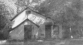
St. Peter’s African Methodist Episcopal Church was located east of 243rd Street (Orient Avenue) between 42nd Avenue and Depew Avenue.
A community of black oystermen existed in Little Neck, some as property owners, since the 1850s. While their homes were located outside the Lambertson subdivision (most along Orient Avenue (243rd Street) near the dock at Old House Landing Road), they contributed to community life. Upon the death of oysterman Jacob Treadwell (1833-1904), the Flushing Daily Times reported “He was a well known character in and about Douglaston, where he has been a life long resident”
This community’s church on Orient Avenue, St. Peter’s African Methodist Episcopal Church, was active for over 100 years: founded in 1872, the church building on Orient Avenue held services until the late 1980s. The Hill’s major period of development coincided with the oystermen’s decline, following the 1909 condemnation of polluted Little Neck oyster beds. While their numbers substantially decreased in the early years of the twentieth century, several ancestors resided in Douglaston for many more years.
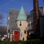
Site of St. Anastasia Parish’s First Mass
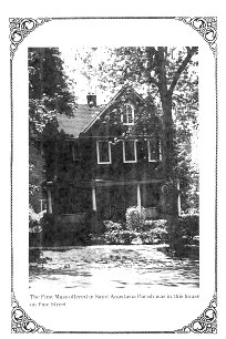
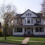
The First Mass offered in Saint Anastasia Parish was in this house on Pine Street (240-16 43rd Avenue). The house was designed by Walter J. Halliday, Jamaica Queens, ca 1909 for the original owner, Adolph Helmus, a paper box manufacturer and member of Douglaston Hose Co. No. 1.
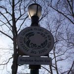
Matinecoc Burying Ground
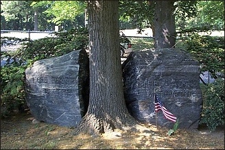
Members of the Matinecoc Tribe settled in Little Neck and established a burying ground along the north side of the main highway, then called Broadway, between 251st and 252nd Streets in what is now Little Neck. In 1931 when the boulevard was widened, the cemetery protruded out into the roadway. The city obtained permission to remove the remains of the Indians interred in this graveyard and to reinter them in a special plot in Zion Churchyard, in order to straighten the highway.
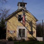
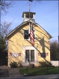
Fire House / Hose Company
 Here’s an image of the old Douglaston Fire House, an Alarm Box sheet, and the Fire House as it is today as the American Legion building. The building stands on Douglaston Parkway (formerly named Main Avenue), west side, between 42nd and 43rd Avenues.
![]()
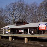
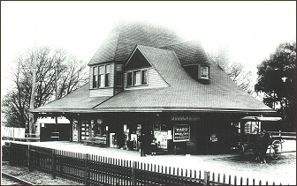
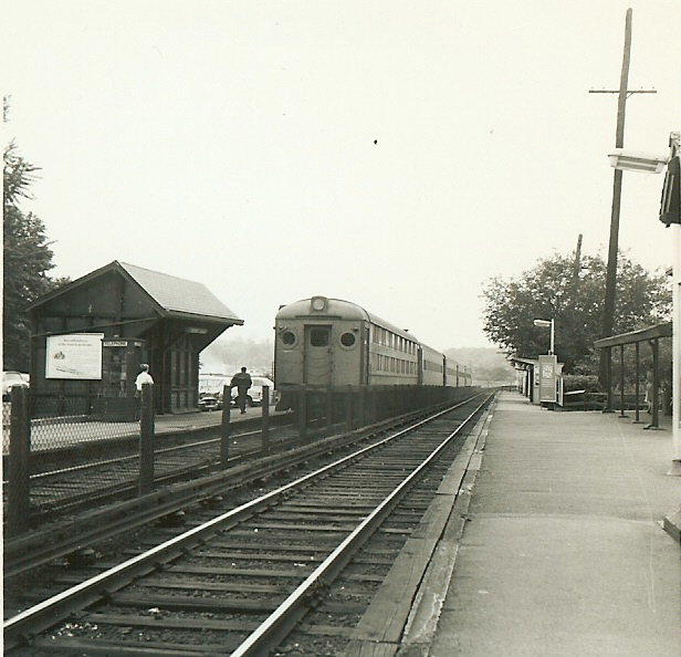
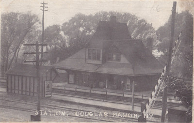
Douglaston Train Station
History of the Douglaston Train Station (Joseph Hellmann, 02/2004: MS Word)
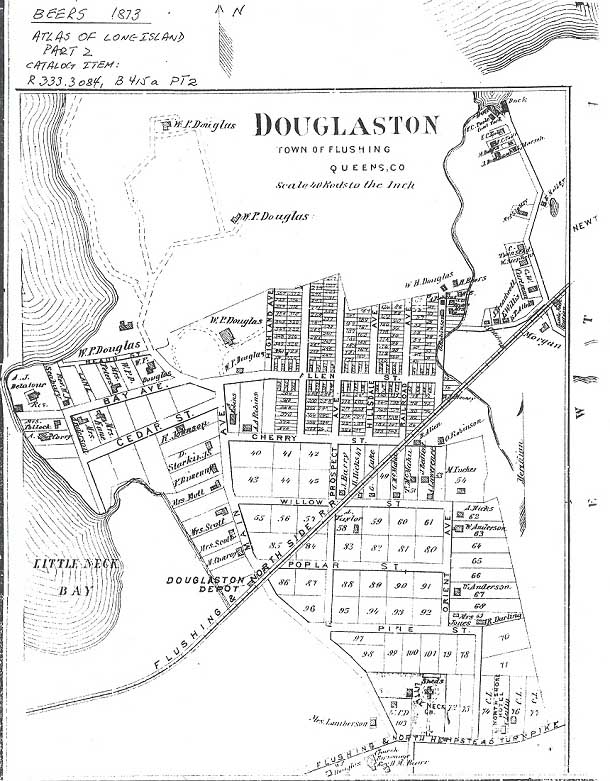
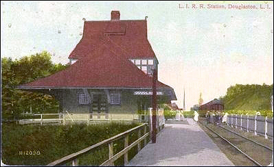
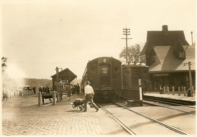
The Flushing & Northside Railroad extended to the Village of Flushing in 1854, and as far as Great Neck, presently Nassau County, Long Island, in 1866. William Douglas donated a farm building from his estate to serve as the railroad station. In exchange, he asked that the station and the village around it be called Douglaston. In 1887, Douglas and resident subscribers funded the Queen Anne-style depot building and landscaping at the new Douglaston station as shown in the picture. Popular postmaster and gardener Albert Benz directed the landscaping project.
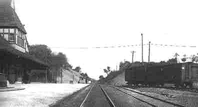
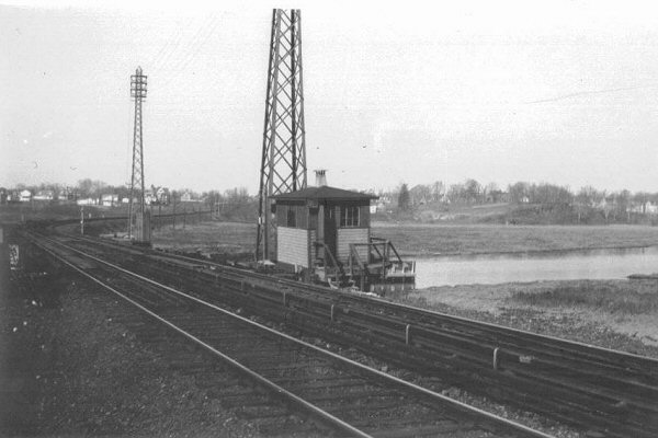
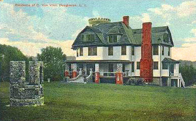
The scene is looking North on today’s 235th Street just past Station Realty at about George Martin’s restaurant. To the left is a wooden sign advertising lots in Douglas Manor. Part of the LIRR station roof can be seen just above the sign. Moving right we see the turret of the Van Vleit mansion with its well manicured grounds. It later became PS 98 and stood until the present building was completed in 1931. On the right at the gate is the crossing watchman’s shanty. The track closest is a spur leading to a small freight yard built in 1866 to accommodate the Alley mills. Just below that we can see the first steps of a wooden stairway leading up to the foot of Poplar Street. The ruble stone wall probably dates to a road widening to accommodate the 1906 development of Douglas Manor and can still be seen North of Willow Street opposite the Community Church. The discoloration in the well graded roadway is from oil used to control dust and hold the sand in place during wet weather. Although many believe our cobble stone gutters were constructed by the Works Progress Administration, and no doubt some were, they were actually a common means of controlling erosion dating to colonial times.
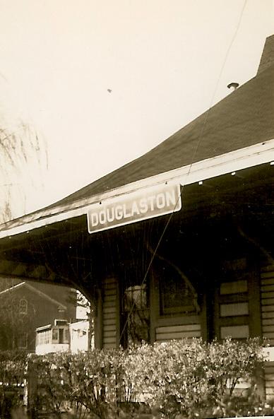
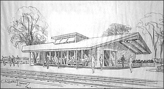
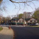
By 1961, the Queen Anne-style building had deteriorated to such an extent that the company decided it was not worth repairing, so plans were instigated to have the building replaced.
Above is shown the architects conception of the new station which has been erected on the site of the former station building. The plans were developed by a Douglaston resident, A. Gordon Lorimer, whose design was accepted by the Long Island Rail Road Company and the Douglaston residents. The new station was formally opened in 1962 and still stands today.
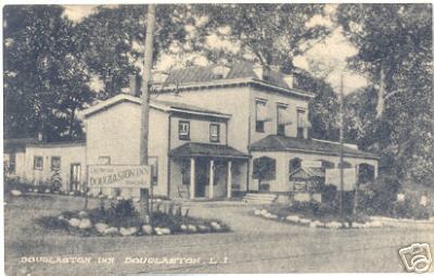
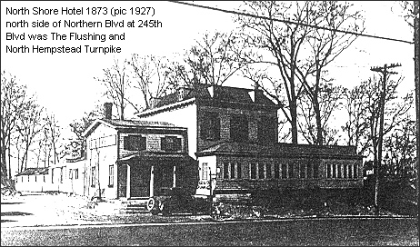
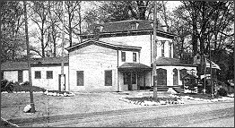
The North Shore Hotel
aka Evan’s Hotel and Douglaston Inn
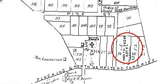
The North Shore Hotel was believed to have been built c. 1850 1 and was located just east of 247th Street (Lot 75 of Map No. 223 of the village of Marathon) on the Flushing & North Hempstead Turnpike (now Northern Boulevard).
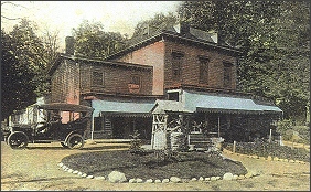
The photographs at right and the large one below show the hotel at three different time periods. They are identified by the names that the business went by at the various times.
Community newspapers chronicle the on-goings at the hotel in some detail:
Flushing Journal 12/13/1890: Drunken vagrant laborer on the North Hempstead Turnpike brought to the North Shore Hotel where he slept in a horse stall.
Flushing Evening Journal 11/6/1897: Proprietors Livingston and Wright report hotel is popular with young people for parties. Henry Snell is having the hotel upgraded with new plumbing and steam heat.
Flushing Daily Times 7/11/1903: Douglaston Hose Company No. 1 celebrates its founding at the hotel now known as Evan’s Hotel.
Flushing Daily Times 10/19/1904 & 11/5/1904: Republican rally takes place at Evan’s Hotel.
Flushing Journal 6/10/1905: Evan’s Hotel filled with summer boarders.
Flushing Daily Times 10/23/1905: Protest meeting concerning proposed school site.
Flushing Daily Times 2/3/1909: Douglaston Civic Association meeting.
Flushing Daily Times 6/17/1909: Dinner given in honor of Norris Mason who worked on a fundraiser for Blessed Sacrament Church in Bayside. Denis O’Leary was toastmaster.
Flushing Evening Journal 1/8/1910: Douglaston Civic Association holds meeting.
Flushing Daily Times 6/13/1910: Civic association meeting again.
In 1915, The hotel was known as the Douglaston Inn. Father Francis J. Uleau, first Pastor of St. Anastasia, held the initial services at the hotel. 2
The Douglaston Inn was closed when prohibition came. It stood idle for some time and was finally taken down in the 1930s 3, most likely during the widening of Northern Boulevard at that time.
Douglaston Art League (Now, National Art League)
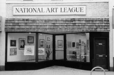
The development of a community connected to the city at large is illustrated in the founding and continuity of the Douglaston Art League in 1930, and still active today (now known as the National Art League, located at 44-21 Douglaston Parkway). The League was founded by Mrs. Arthur Sullivan and Miss Helen Chase – sisters and daughters of New York painter William Merritt Chase – along with other residents and north shore artists who were “interested in arousing amore general appreciation of art in the community and in providing a means for practical development of individual talents.” Architect Aubrey Grantham (Zion Episcopal Church) was among the founders. The League’s early exhibits and classes were held in the backroom of a beauty shop and its second show was exhibited in the Parish Hall of Zion Church.
National Art League
In the first quarter of the 20th Century, there existed a thriving arts and theater colony in Douglaston. It included such luminaries as Ginger Rogers, Hedda Hopper, Annette Kellerman, Robert Haggart, George Grosz and many others. A natural consequence of this artistic climate was the establishment of the National Art League (NAL), presently located on Douglaston Parkway. The NAL, originally called the Douglaston Art League (DAL), was founded in 1932. The DAL was the brainchild of the daughters of American Impressionist painter, William Meritt Chase, along with Aubrey Grantham, the architect for the rebuilt Zion Church, James Boudreau, Director of Pratt Institute, and most notably Trygve Hammer, sculptor and wood carver. A naturalized citizen by 1913, Hammer designed rooms for the University of Pittsburgh, the Scofield Memorial Library, and the Waldorf Astoria. Locally, his imprint on the Zion Church remains in his wood carvings there.
The Zion Church has been intertwined with the DAL from the start, not just by virtue of its relationship with the founding members. Reverend Riley is credited with becoming the second patron of the Art League after permitting the exhibition of Chases’s art work at the church. This exhibit caught the attention of the NY Press as well as the art world.
The North Shore Daily Journal, dated November 2, 1933, announced the first exhibit, held at 40-41 Douglaston Parkway, home of the Manor Beauty Salon, and loaned to the DAL by Lucas Mack, making him the first patron of the Art League.
The DAL eventually moved to a location in Flushing, and became known as the Art League of Long Island. Guiseppi Trotta, a portrait painter of men on both the Supreme and New York Bench, lent his studio in Flushing out to the League. Subsequent to the relocation, several articles in the LI Star Journal and Society indicate that the objective of the Art League “to stimulate public interest in the Arts” continued to be met. On February 21, 1948, the Journal reported the addition of painting and sketching from life to its instruction. According to Frank L. Moratz, the director of classes, this resulted in “booming business” for the League. There were published announcements of lectures, and on March 14, 1948, Society announced the opening of the spring exhibition. It should be noted that Mr. Moratz was a mural and portrait painter who also sponsored an exhibit for the Red Cross at Flushing Library. It was hoped that through innovative programs and exhibitions of this sort, the League could continue successfully and might one day have a permanent home.
Louisa Gibala brought this to fruition with her tireless efforts in 1955. The League now resides permanently at 44-21 Douglaston Parkway. In 1968 it established the name that hangs above that address, the “National Art League”.
By: Ellen Dermigny, May 10, 2002
National Art League a Hidden Treasure
From the Queens Ledger*Glendale Register*-LIC/Jackson Heights Journal*Forest Hills Times*Leader/Observer*Queens Examiner, May 24, 2001, page 22
By Judi Willing
Hidden in Douglaston is an organization for serious artists. It is run by men and women committed to the idea that artists need to be nurtured. Whilst the creative process dictates that an artist should primarily create for him/herself rather than for a patron, there is no doubt that the creative process can be stimulated by contact with others – patrons and other artists.
To this end, the National Art League offers a location where successful artists teach, lecture and ‘cheer those that need encouragement.’ In return they are offered the opportunity to learn from other artists, and further their careers by showing their work regularly in exhibition and receive encouragement themselves in the form of awards and prizes.
The National Arts League is a non-profit organization open to all artists and lay members of the public. To join as an artist member, three works of art must be submitted to a judging committee. The annual membership is $25, and artist members can submit works for consideration in the League’s exhibitions and win awards. Last year there were 12 exhibitions in different categories-students, children, members, teachers, photography.
Non-artists can also join for $25 per annum, or at higher levels of sponsorship. Members can enjoy classes in watercolors, oil or mixed media (acrylic, collage and sculpture) – $15-20 per 3 hour class during the day or evening. There is a library, group trips to galleries, and studio space available. There are special workshops where artists talk about their methods and techniques. There is a course starting in graphic design, probably in September.
Currently the Spring Open Exhibition can be viewed. On Sunday May 20, 2001 between 1 and 4pm, there will be a reception for the artists, and awards given. The National Arts League is at 44-21 Douglaston Parkway, Douglaston, NY 11363. Telephone 718 224-3957. E-mail: artworknal@aol.com
Website: www.nationalartleague.org. If you are seriously interested in art, the National Art League is interested in you, and can offer a lot in return.
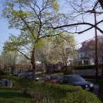
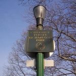
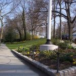
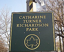
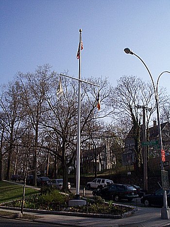
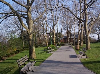
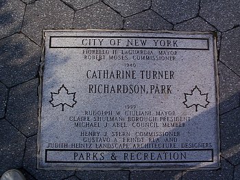
Catherine Turner Richardson Park
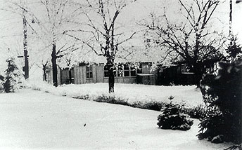
The Little Neck School Annex
The Early Schools
PS 32 Annex, (1910/1920)
Located in Catherine Turner Richardson Park, at 42nd Avenue and Douglaston Parkway. This school was a branch of PS 32 located at Little Neck Parkway and Lakeville Road. It was established to serve the growing Douglaston community.
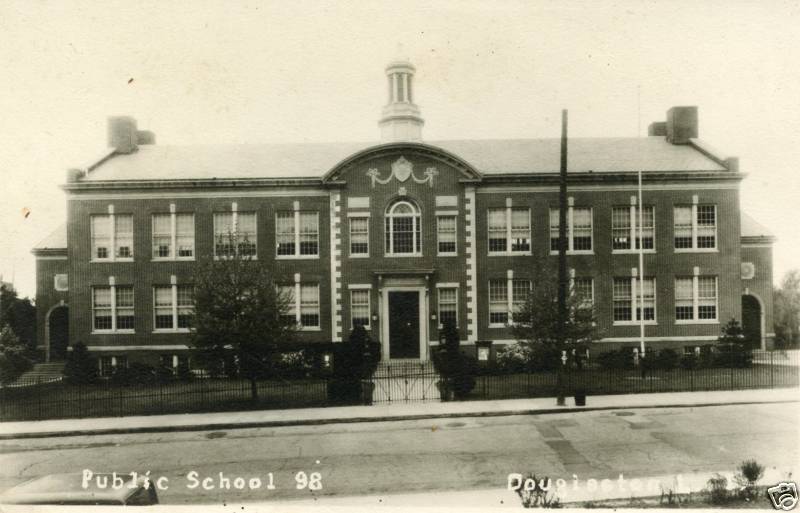
PS 98 (Provisional) (1920/1931)
Continuing growth required a move from the Annex to this building. Located on the present site of PS 98, (Douglaston Parkway and Willow Street). It had been the previous home of Clinton Van Vleit, an executive with Goodyear Tire and Rubber Co.
Noteable Residents
Julian Caplan, Attorney & Mark Twain Impresario
Gertrude Moll, Suffragette activist
John McEnroe, Tennis Champion
Ed Lauter, Actor
Arthur Treacher, British Actor
Ralph Batcher, Telecommunications Inventor
John Cannella, Federal Judge, Football Player
Building Survey
Douglaston Hill National Register Historic District
INCLUDING BLOCK AND LOT NUMBERS AND POSTAL ADDRESSES
Architectural Classification
- Late Victorian – Queen Anne
- Late Victorian – Shingle Style (influences)
- Late 19th and 20th Century Revivals – Colonial Revival
- Late 19th and Early 20th Century American Movements – Bungalow/Craftsman
Materials
- Foundation: Stone; Brick
- Walls: Wood – weatherboard, shingle, porch supports, half-timbering; Brick; Stucco; Asbestos; Metal – aluminum, copper; Terra Cotta
- Roofs: Asphalt; Stone – slate
- Other: Belgian block streetscape elements
Narrative Description
The development of Douglaston Hill began in earnest in the 1890s, but the heart of the community dates to a half-century before, with the founding and construction of Zion Episcopal Church. At the time of its completion in 1830, Zion served a far-flung community, and was known throughout Douglaston-Little Neck as “the white church on the hill.”1
Zion’s first building was constructed with local materials (with the exception of the window glass), and built by local artisans from plans by prominent New York architect Richard Upjohn.2 This first building had neither chancel nor middle aisle, and is remembered in local histories as a simple country church. In 1862, in memory of his father, William P. Douglas enlarged Zion Church by the addition of a chancel and vestry room, and enriched the interior with stained glass windows and a pipe organ. A Parish House was built nearby in 1896-97 and became the social center of the parish and the entire community. Monthly socials were held as well as annual fairs, strawberry festivals, and church suppers.
A fire in 1924 destroyed the Church and heavily damaged the Parish Hall. Local architect Aubrey Grantham (with builder Samuel Lindbloom) was asked to rebuild, and modernize, the Church. His composition incorporated the community’s suggestions for a longer nave and a spire to replace the earlier square tower, and resulted in a restrained and dignified design – which was a featured illustration in Architectural Record of March 1927. The design is a simplified expression of Colonial Revival, with clear antecedents in the American colonial churches derived from Sir Christopher Wren – wherein horizontal classical forms combine with the Gothic verticality of a central tower. The Parish House, rebuilt at the same time, shares the simple and elegant design elements of the sanctuary, while providing for a range of community functions, such as a 150-person auditorium, kitchen and meeting rooms.
An acre of land for Zion‹s church yard was donated in 1834. In 1885 Bloodgood Cutter donated two acres to the east of the church in memory of his wife. Together the cemetery plots comprise 7 acres of grounds; an acre and half parking lot is across 44th Avenue from the Parish House. The cemetery features several notable gravestones, including a large stone cross marking Bloodgood Cutter’s grave, and the memorial to the reinterred Matinecoc Indians – a dramatic version of their tribal sign, a tree growing from a split rock. Additionally, the church grounds features numerous old, specimen trees, such as Japanese maples, sweet cherry trees, black locusts, a pagoda tree and two Kentucky coffee trees.
At the turn of the century Douglaston Hill‹s built environment included Zion Church, several small structures along Orient Avenue, many of which belonged to oystermen,3 and a few farmhouses. 105 Depew Avenue and 240-27 Depew Avenue are two of the oldest houses in the Historic District, dating from the mid-nineteenth century and, like the oystermen‹s houses, represent the organic development of the Hill. Other than these, maps of Douglaston Hill from 1873 and 1891 show one structure on the lots laid out in 1853. By 1902, seventeen structures were mapped, and by 1909, nearly half of the houses within the Historic District were constructed.4 All but a few were completed by 1930.
At the turn of the 19th century, many of the generous lots were subdivided, wherein the 200‹ front-to-rear dimension was retained but the 200‹ side-to-side dimension was diminished. While lots throughout the district now vary in size, the site plans of the majority of houses help maintain the uniformity lost by those subdivisions. On most streets, nearly all the houses are sited along the same plane — near the street and centered on their lot, with car storage off the street and mature trees providing canopy from the rear. Those which retained a 150‹ to 200‹-deep yard, particularly along the north side of 43rd Avenue, have carriage houses, barns and garages placed at the rear of the long yard.5
Sidewalks, historic Belgian block gutters on several blocks, and a nearly continuous use of Belgian block curbstones further add to an atmosphere of coherent design and shared public spaces along the street. The historic gutters are largely intact along 240th Street, 43rd Avenue and the southern end of 243rd Street.
Most houses in Douglaston Hill combine stylistic elements from those architectural styles popular from 1890 to 1900. This relatively consistent use of popular styles contributes to the district‹s overall integrity of visual coherence, materials and workmanship. Mass produced construction components and rail transportation gave rise to the freer plans and stylistic excesses of the Colonial Revival style, which influenced the Late Victorian Queen Anne and Shingle Styles. These three styles, and their vernacular complement, predominated for Douglaston Hill houses built prior to 1910. The picturesque qualities of weatherboard and wood-shingle cladding, intersecting rooflines, tall brick chimneys and spacious porches link many of the houses from this period. An eclectic use of classically inspired detailing, characteristic of the Colonial Revival style, is prevalent throughout the Hill: patterned shingle ornament, Palladian window groupings, classical door and window surrounds and pedimented porticos.
The Hill’s early speculative houses reflect a combination of stylistic influences – and particularly illustrate how such influences are incorporated into basic vernacular forms by local builders. The four houses at 240-24, 240-38, 240-40, 240-42 42nd Avenue (built by Douglaston resident William J. Hamilton in 1903) feature a complicated intersection of gables and multi-level eaves common in the high-style Shingle houses of the 1880s, yet they are modestly-scaled and otherwise simple architectural expressions. Two other speculative houses built by Hamilton in 1908 – 43-17 and 43-11 242nd Street – also illustrate this response. The basic American foursquare plan is architecturally elevated by incorporating classical door surrounds, by a symmetrical treatment of fenestration, and by modest decorative features such as eave brackets. The houses maintain a vernacular simplicity, while also expressing a link to popular architectural styles.
The houses along the western end of 43rd Avenue illustrate a more stylized expression of the Colonial Revival, Queen Anne and Shingle Style idioms. Particularly, 240-25 and 240-35 43rd Avenue feature many high-style decorative elements — such as the deep semi-elliptical entry porch with classical entry surround and Tuscan column porch supports; and complex treatment of window groupings, including a Palladian window complemented by decorative swags. These houses were designed by architect D.S. Hopkins in 1901 for two prominent families, who were also developers of the Hill. On the south side of 43rd Avenue, a row of four houses, 240-16, 240-22, 240-40 and 240-42, illustrate those same stylistic influences in form as much as ornamentation – with deep porches under the roofline, prominent central bay windows and dormers, and elliptical-arched porch openings.
In the 1920s, subdivision of lots continued, and more modest homes, a few multi-family dwellings and a commercial strip at Douglaston Parkway and Northern Boulevard filled out the development. The Hill houses built during this period reflected the popularity of and Tudor Revival and Craftsman styles. The steep sloping roof, exposed rafters and decorative brackets characterized the Craftsman. Several single-family homes and the three multi-family complexes in Douglaston Hill were built in the Tudor Revival style, incorporating steeply pitched roofs, patterned brick work (and the use of “clinker” brick), overlapping gables and the use of stucco and faux half-timbering. Three multi-family complexes are nicely incorporated into the over residential character of the District, while maintaining their own sense of individuality.
Individual Building Sites
Click the photographs to see them enlarged!
Key:
- Contributing: largely intact — slight modifications, such as removal of ornament
- Contributing: slightly altered — changes to original cladding or windows
- Contributing: altered — enclosed porch, major additions
- Contributing: heavily altered — numerous

Contributing: slightly altered. Colonial Revival-style church, front-gabled roofline, two shallow cross gables on axis with the chancel (originally functioning as organ and rector’s rooms). White weatherboard cladding – original cladding intact on steeple and spire; façade and gable cladding replaced by aluminum siding as is cornice and frieze.
The front façade features a projecting front-gabled vestibule reaching to the horizontal cornice line of the main pediment. Rising behind the main pediment, a square bell tower supports the spire. (A third front-gabled projection, just behind and extending below the front vestibule was added after original construction.) Except for a famed plaque depicting the Church name, the façade is devoid of ornament. A tall, paneled double-door entry features a simplified classical surround. Seven (four along the east facade, three along the west) 16/16 double-hung sash windows light the sanctuary, and feature glass tinged with a lavender hue.
The sanctuary’s interior proportions are classical, with longitudinal orientation toward the altar. Slightly raised, the apse chancel is framed by a wooden segmental arch supported by pilasters and capped with a wooden keystone. The springline of the chancel arch extends the circumference of the apse, above which three recessed circular windows light the chancel. Zion’s reredos is a simple wood surround crowned by cross in the center of a broken scroll pediment. Other interior features include a wide center aisle, scroll-topped pews, plaster barrel-vaulted ceiling, and a rear paneled balcony supported by Tuscan columns.
A 1-story wing connects the sanctuary to the Parish Hall, a side-gabled roofline with vestibule in projecting front gable. Rebuilt in 1925 along with the sanctuary, this hall is equally modest in form and detailing. Its front façade features a gabled-front vestibule with cornice returns and a round-headed entry surround. A paneled double-door is flanked by Tuscan pilasters and fanlight. Palladian-motif window groupings flank the vestibule – 12/12 double-hung sash windows flanking central 18/18 double-hung sash windows capped by lighted round arch.
Zion Church is sited on the high point of its 7 acres of grounds, facing Northern Boulevard. Cemetery plots fill the east and west yards. A tall, fieldstone wall borders the southern end of the property along Northern Boulevard, with an opening for an on-axis approach road onto the property. An acre and a half parking lot is across 44th Avenue from the Parish House. A two-car frame garage sits in the western section of cemetery.

Contributing: largely intact. 2 ½-story, single-family house, box plan (prior to rear additions), symmetrical façade treatment, front-gabled roofline. Blue weatherboard, with blue wood-shingled gables (mixed pattern). “Free classic” mix of Queen Anne and Colonial Revival stylistic elements: full-front wrapped wood porch with turned spindle supports; shallow cross-gable 2-story bay; hipped bay window; bracketed eaves; pronounced window crowns and sills; Palladian window in front gable; arched attic windows in side and rear gables; classical door surround, with paneled door with leaded transom and sidelights. Alterations include 2-story pyramid hipped roof rear extension; and 1-story shed-roof rear entry wing. Landscape elements include mature trees in extensive lawn.

Contributing: largely intact. Contributing: largely intact. 2-story commercial strip, flat roof, continuous decorative parapet crested at each end, with large central pediment. Beige brick and terra cotta cladding. Classically inspired detailing includes: 2-story terra cotta pilasters marking divisions between stores; continuous cornice-line modillions and dentils; continuous terra cotta frieze and string course; cartouche in central pediment. Double-hung sash windows line the upper floors (some original 6/1 remain). overall integrity strong; alterations include: painted brick in central section; modified storefronts; variety of awnings and signage.

Contributing: largely intact. 1-story commercial building, flat roof with crested parapet, featuring bas-relief medallion announcing building date. Beige brick and terra cotta cladding. Classically inspired detailing includes: pilasters across facade, continuous cornice-line dentils; formal entry with recessed surround and bracketed cornice. “Douglaston National Bank of New York” is engraved in frieze, and window grilles feature stylized “DNB” logo in iron. Original paneled double-door with transom light.

Contributing: largely intact. 2-story commercial strip, deck roofline, punctuated by four prominent front-gabled sections. Brick and stucco cladding. Tudor Revival elements include: steeply pitched gabled-front forms with half-timbering in gables and along the spandrel (diamond-patterned); deep eave overhangs, with exposed rafters. 1/1 double-hung sash windows at the second story. Relatively few alterations to brick storefronts; new uniform stationary awnings.

Contributing: slightly altered. 2 ½-story single-family house, American foursquare plan, hipped roofline. Asbestos shingle cladding. Colonial Revival elements include: centered, concrete entry porch with square post supports and simple entablature; paneled door with transom and pilaster surround prominent central Palladian window with original lights at 2nd story; centered hipped dormer with a triple window group; 1-story shallow intersecting hipped bay. Alterations include a 1-room addition at side with screened porch at 2nd story. A two-car hipped roof garage shares the small lot.
Contributing: largely intact. Six 2 ½-story multi-family dwellings (two- and four-unit buildings), rectangular plan, paired cross-gabled rooflines in front and parallel-hipped in rear. Red brick cladding, with clinker brick accents. Each building’s single entryway provides a strong semblance to single-family homes, in deference to the neighborhood context. Strong Tudor Revival stylistic elements include: grouped casement windows on façade and in dormers (most intact, some replaced); slate roofs. Entryways are subtly different on each building, i.e., shed-roofed enclosure with classical surround, paneled door with fanlight; front-gabled enclosure with round arched surround; front-gabled enclosure with pilaster surround and sidelights; front-gabled, recessed entry. Some buildings include subterranean garages; others have new shed garages. Landscape elements include stucco and brick retaining walls, rear gardens and mature trees.

Contributing: slightly altered. 2-story, single-family house, massed plan, side-gabled roofline. White aluminum siding. Colonial Revival elements include salt box form with low sweeping roof to cover a broad entrance porch with square post supports. A full-length pent-roofed dormer across the porch lights the second floor. Exterior, gable-wall chimney in brick dominates west facade. Alterations include a long, low wing added in the 1940s, producing an L-configuration. Landscape elements include specimen trees and garden terrace behind white picket fence at property line.

Contributing: altered. 2 ½-story single-family house, American foursquare plan, hipped roofline. White asbestos shingle cladding. Colonial Revival elements include: bracketed eaves; central hipped dormer with lattice lights; full-front hipped; 2-story, shallow intersecting hipped bay on north facade. Boxed eave overhang, with wooden brackets. Alterations include: enclosed porch with new door and windows, column supports intact. A 1-car front-gabled garage at. Landscape elements include border shrubs.

Contributing: slightly altered. 2 ½-story single-family house, American foursquare plan, hipped roofline. White asbestos shingle cladding. Colonial Revival elements central hipped dormer with paired windows; full-front hipped wood porch simple column supports; paneled door with finely wrought cornice and pilaster surround; 2-story shallow intersecting hipped bay on north façade. Boxed eave overhang (brackets removed). Alterations include 1-story rear addition with roof deck. 2-car cinder-block hipped-roof garage at rear. Landscape elements include border shrubs.

Contributing: heavily altered. 2 ½-story single family house, American foursquare plan, hipped roofline. White aluminum siding and boxed eaves. Colonial Revival elements include: full-front hipped porch; central hipped dormer; 2nd-story bay window over off-center entryway; 2-story shallow intersecting hipped bay. Heavy alterations include enclosed porch with new windows and door inset; garage enlarged to serve as both garage and sunroom, connected to main house by on-story wing. Landscape elements include stone and concrete perimeter retaining wall.

Contributing: largely intact. 2 ½-story single-family house, cross-gabled roofline. Asphalt-shingle cladding at 2nd and attic stories, restored wood-shingle cladding at 1st story. Stylistic mix of Colonial Revival and Queen Anne: full-front hipped wrapped porch, with Tuscan column supports and plain balustrade; full eave return on front gable; arched window at attic story with original pane configuration; three 1/1 double-hung sash windows across front. Three-car garage at rear. Landscape elements include mature trees in rear; mature shrubs in front.

Contributing: largely intact. 2 ½-story, single-family house, cross-hipped roofline. Aluminum siding and boxed eaves. Mix of Colonial Revival and Queen Anne stylistic elements: full-front hipped curving wrapped porch, with Tuscan column supports and plain balustrade; two hipped dormers (some with original multipane lights) across front, central dormer in cross-hipped projection; two hipped dormers on west façade; sidelighted front entry; an unusual 35-light upper sash on porch; pronounced window crowns and sills. End chimney partially exposed. Landscape elements include mature trees in rear; border shrubs and plantings, slate and concrete drive.

Contributing: largely intact. 2 ½-story single-family house, American foursquare plan, hipped-roofline, symmetrical façade treatment. White wood-shingle cladding. Colonial Revival (and some Shingle style) elements include: prominent, central projecting octagonal bay at the second story, with three 6/6 sash windows, roof-line balustrade, and paneled fascia – all crowned by gabled dormer with deep, flared eave, bracketed overhang and full eave return; full-front porch with shingled supports (porch enclosure used original elliptical arched forms to frame multi-light windows); shingled, gabled dormers centered on side facades; one side includes a cantilevered, hipped-roof window. Second story is cantilevered at rear. Landscape elements include mature trees and thick shrubbery and ground coverings.

Contributing: largely intact. 2 ½-story single-family house, American foursquare plan, hipped roofline with cross gable for attic light. White wood-shingle cladding. Colonial Revival (and some Shingle style) elements include: central projecting octagonal bay at the second story with roof-line balustrade, and paneled fascia; small Palladian window at attic story; full-front porch with shingled supports, three large elliptical arched openings at front and sides; central entry in slightly projected vestibule; shingled, gabled dormers centered on side facades; one side includes a cantilevered, hipped-roof window. Small 1-car front-gabled garage at rear. Landscape elements include mature trees in rear.

Contributing: altered. 2 ½-story, single-family house, irregular plan, cross-gabled roofline. Aluminum siding. Mix of Colonial Revival and Queen Anne stylistic elements include: slightly projecting gables on four sides; front gable features recessed, paired attic windows; pedimented portico at center of full-front wrapped wood porch with plain column supports and spindle balusters. Alterations include: front wing addition, encompassed west end of porch; eave overhangs and attic window surround boxed in aluminum siding. Landscape elements include mature trees in rear, mature border shrubs.

Contributing: slightly altered. 2 ½-story, single-family house, modified cross-gabled roofline, cross gables for attic light on front and east facade. Asbestos-shingle cladding. Mix of Colonial Revival and Queen Anne stylistic elements include: flared-eave porch roof features a three-part inset dormer, with latticed-light rectangular window flanked by paired 1/1 double-hung sash windows; half-front wood porch with attenuated column supports and plain balustrade; paired lattice light window in front gable; cantilevered shed-roof window on east facade. Rear façade incorporates a small inset porch with sleeping porch above. Landscape elements include mature perimeter hedgerow.
Contributing: heavily altered. 2 1/2-story, single-family house, massed plan, modified gambrel roof. “Wood-grained” aluminum siding. Heavily altered: enclosed front porch with plate-glass windows across front; exaggerated central gabled dormer with interpretation of a Palladian window motif. Two-car garage on north edge of property.

Contributing: largely intact. 2 1/2-story, four-family residence, U-shaped plan, modified front-gabled roofline with superimposed steep gable form on fronts ends of “U.” Rough, gray stucco surface. Tudor Revival elements include: half-timbering in gables; steep gable forms; grouped windows. Recessed entry courtyard created by 2nd-story balcony with parapet, connecting the rear of the main gabled forms. Courtyard entrance marked by long sides of front gables – only four feet from the ground. Four entries are concealed by balcony. Diminutive gable form with half-timbering is centered above balcony floor. Some original 6/6 sash windows remain. Three-car garage, Tudor-style garage, with original wood doors is at rear of lot.

Contributing: largely intact. Two, mirrored 2-story, two-family residences, L-shaped plan, multiple front-gabled roofline, with round tower tucked into front façade. Beige stucco surfaces and brick cladding (with clinker brick accents). Tudor Revival elements include: half-timbering detailing in gables; overhanging gables; multi-colored slate roof; grouped windows along side facades; conical, copper roof on tower; rough stone quoining. Red “Dutch” doors with strapped hinges. Prominent exterior brick chimney. Subterranean garage of complementary design and detailing. Landscape elements include brick retaining wall, mature shrubs, ivy and hedge borders.

Contributing: heavily altered. 2 ½-story single family house, American foursquare plan, hipped roofline. White aluminum siding and boxed eaves. Colonial Revival elements include: full-front hipped porch; central hipped dormer; 2nd-story bay window over off-center entryway; 2-story shallow intersecting hipped bay on side facade. Heavy alterations include: enclosed porch with new oriel, multi-light windows and door inset. Landscape elements include stone and concrete perimeter retaining wall.

Contributing: largely intact. 2 ½-story, single-family house, irregular plan, side-gabled roofline with corner tower and full-width porch (now enclosed). Blue weatherboard at first story, and wood-shingle cladding at second story and dormers. Queen Anne stylistic elements include polygonal tower with conical roof, paneled frieze, and exposed eave brackets; hipped dormer with paired square windows; most windows 4/4 double-hung sash, with one small, arched window hood with keystone and original small-pane surround; projecting side gable and flared drip mold. Alterations include: enclosed porch, with louvered windows and aluminum front door inset; porch pediment retained, marking entry. Landscape elements include siting on terraced berm high above street, border plantings, cobblestone gutter and fieldstone retaining wall at sidewalk. A front-gabled weatherboard garage is at rear.

Contributing: largely intact. 2 ½-story, single-family house, rectangular plan, cross-gable roofline. White stucco surface. Tudor Revival stylistic elements include: half-timbering detailing in front and side gables; steeply pitched roof; three-bay oriel with flared copper roof on front gable façade; horizontal band of square windows in shed dormer; prominent end chimney clad in stucco; deep partial porch under sloping; bracketed post supports and simple balustrade. Wood and stucco garage at rear. Landscape features include: siting on a terraced berm above the street, mature trees, cobblestone gutter and tree pit at sidewalk.

Contributing: largely intact. 2-story, single-family house, rectangular plan with porch wing, side-gabled roofline. Blue wood-shingle cladding. Colonial Revival elements include symmetrical façade; strong cornice line; accentuated entry portico with open pediment and cornice return, supported by finely wrought pilasters and columns; pronounced window surrounds; 6/6 double-hung sash windows; paneled door with multiple sidelights and fanlight. Alterations include: metal awning covering the porch wing’s roof platform. Landscape features include cobblestone gutters and tree pits, bluestone curbs and mature shrubbery. A small front-gabled garage is at rear.

Contributing: altered. 2-story, single-family house, main section is rectangular form with front-gabled roofline, two well-proportioned gabled wings and a shed-roof attached-garage at rear, porch added on north facade. Weatherboard cladding. Mix of colonial stylistic influences. Adam Colonial: strong cornice; pedimented window enframements. Dutch Colonial: deep flared porch eave with post supports. Other early American elements include: bracketed eaves; prominent exterior, eave chimney. Alterations: anecdotal/oral history evidence indicates that this house was moved from the corner of Douglaston Parkway and Northern Boulevard (now site of commercial strips) in the mid-1920s. Several alterations and additions presumed to have happened after the move – e.g., main entry (now located in rear wing, approached via porch) presumed to have been in gable front facing 240th Street. Landscape elements include mature trees set in large lawn, perimeter hedge along 42nd Avenue.

Contributing: slightly altered. 2-story single-family house, irregular plan, modified front-gabled roofline – front gable projects from flared-eave form. Blue aluminum siding. Colonial Revival elements include: cornice return on gable; inset shed dormer on west façade; triple window grouping on side façade; pilaster entryway surround, wooden segmental pediment, paneled door; wooden segmental pediment over front façade window grouping. Alterations include: wood spandrel on front gable facade; louvered window group; shed roof addition across rear façade; new garage door. Sloping site allows for subterranean garage, hidden by retaining wall and landscaping. Landscape elements include mature trees and shrubs.

Contributing: altered. 2-story single-family house, American foursquare plan, modified cross-gable roofline. White wood-shingle cladding. Shingle style elements include: multi-level eaves with slight flares and shingled cornice returns; unusual window placement under eaves at intersection of truncated gables. Queen Anne elements include: full-front wrapped hipped-roof porch with Tuscan column supports and simple balusters; pronounced window crowns and sills. Alterations include partial enclosure of porch. Small front-gable shed at rear. Landscape features include large rear yard with mature trees; low cobblestone retaining wall at sidewalk.

Contributing: altered. 2-story single-family house, American foursquare plan, modified cross-gable roofline. White wood-shingle cladding. Shingle style elements include: multi-level eaves with slight flares and shingled cornice returns; unusual window placement under eaves at intersection of truncated gables. Queen Anne elements include pronounced window crowns and sills. Alterations include removal of original front porch, replaced by pedimented porch hood supported by metal piers. 1-story screened porch addition at rear. Front-gabled garage in rear. Landscape features mature trees at rear; low cobblestone retaining wall at sidewalk.

Contributing: slightly altered. 2-story single-family house, American foursquare plan, modified cross-gable roofline. Asbestos shingle siding. Shingle style elements include: multi-level eaves with slight flares and shingled cornice returns; unusual window placement under eaves at intersection of truncated gables. Queen Anne elements include: full-front hipped-roof porch with Tuscan column supports and simple balusters; pronounced window crowns and sills. Alterations include: 1-story addition at rear. Landscape features include mature trees in front and rear.
Contributing: altered. 2-story single-family house, American foursquare plan, modified cross-gable roofline. White wood-shingle cladding. Shingle style elements include: multi-level eaves with slight flares and shingled cornice returns; unusual window placement under eaves at intersection of truncated gables. Queen Anne elements include pronounced window crowns and sills. Alterations include removal of original front porch, replaced by gabled entry porch supported by metal piers. 1-story addition at rear. Landscape features include mature trees at rear.

Contributing: largely intact. 2 ½-story single-family house, American foursquare plan, front-gabled roofline, with shallow intersecting gable on west facade. White wood-shingle cladding. Mix of Colonial Revival and Queen Anne stylistic elements include: symmetrical fenestration on front façade; full-front hipped porch; projecting gable at attic story on front and intersecting gables; cantilevered wall extension on east facade. Sloping site allows for a full-story brick basement. 1/1 double-hung sash windows. Alterations include: enclosed porch with original pilaster door surround incorporated; “suburban” screen door on basement entry. Landscape elements include mature trees.

Contributing: slightly altered. 2 ½-story, single-family house, American foursquare plan, front-gabled roofline. Grey aluminum siding. Mix of Colonial Revival and Queen Anne stylistic elements include: symmetrical fenestration (4/4 double-hung sash) on front façade; front gable projects slightly at cornice and attic levels; gabled dormers with cornice returns and paired windows on side facades; hipped bay on east façade; full-front hipped wood porch with Tuscan column supports, spindle balusters. Front entry and two full-story windows have matching wood surrounds. Landscape elements include mature trees and shrubs.

Contributing: largely intact. 2 ½-story single-family house, American foursquare plan, hipped roofline. Brown wood-shingle cladding. Mix of Colonial Revival and Queen Anne stylistic elements include: symmetrical treatment of fenestration (1/1 sash windows) on front façade; full-front gabled, wrapped wood porch supported by Tuscan columns and plain balusters; shingled gable dormers with cornice returns and paired 1/1 windows all sides; central roof platform around an interior chimney, with paneled parapet and urn finials. Two small barns in rear: one likely dates to construction of the house; a second likely predates the house. Landscape elements include mature trees at rear.

Contributing: largely intact. 2-story single-family house, irregular plan, Jerkin head gabled roofline. Red wood-shingle cladding. Shingle Style influences include a complex intersection of rooflines — hipped roof partial porch and flat roof dormer dominate the front façade; enclosed porch with tripartite and paired multi-light windows in elliptical enframements; modest decorative detailing such as a bracketed cornice at the Jerkin head roof ridge. Prominent end chimney features Flemish bond brickwork. Landscape elements include mature trees and shrubs.

Contributing: largely intact. 1 1/2-story single-family house, irregular plan, low pitched gable roofline. Brick cladding. International Style and Prairie stylistic elements include horizontal window panels; overhanging eaves with exposed, paired roof beams; board and batten detailing on attic story; off-center entry with prominent stone porch. Landscape elements, such as mature trees and other plantings, are integrated into the house design.

Contributing: largely intact. 2 ½-story single-family house, irregular plan, front-gabled roof. White weatherboard cladding, with white wood-shingled gables (mixed pattern). Mix of Queen Anne and Colonial Revival stylistic elements: symmetrical treatment of front façade; full-front wrapped wood porch with column supports and spindle balusters; shallow cross-gable on west facade; hipped bay window on east facade; bracketed eaves; pronounced window crowns and sills; Palladian window in front gable; arched attic windows in side and rear gables; classical door surround, with pilasters and entablature, paneled door with leaded transom and sidelights. A small frame garage is at rear. Landscape elements include mature trees at rear.

Contributing: largely intact. 2 ½-story single-family house, American foursquare plan, hipped with cross-gabled roofline. White weatherboard. Largely intact “Free Classic” Queen Anne. Bracketed eaves on hipped section and hipped dormers. 1/1 double-hung sash windows, some with ornamental crowns. Deep, semi-elliptical entry porch with Tuscan column supports resting on plain balustrade; strong cornice line topped with roof-line balustrade; paneled door with beveled oval light. Gabled front projects slightly framed by corner pilasters; the apex is treated as a pediment and base resting on cornice returns. East façade gabled dormer features a projecting apex to frame an elaborate Palladian window, with original lights, and the roofline is broken to accommodate ornamental swags on frieze below the window group. A side-wing sun porch features pilaster supports, is topped by a roof-line balustrade and rests on a visible stone foundation. Carriage house/garage at rear. Landscape elements include large rear yard with mature trees, mature hedgerow at front of house. Original 1853 lot subdivided only once.

Contributing: slightly altered. 2 ½-story single-family house, American foursquare plan, hipped with cross-gabled roofline. Aluminum siding and boxed eaves. “Free Classic” Queen Anne, with substantial original ornament removed. 1/1 double-hung sash windows, no ornamental crowns remain. Deep, semi-elliptical entry porch with strong cornice line; Tuscan column supports resting on plain balustrade (roof-line balustrade removed. Gabled front projects slightly (corner pilasters removed); the apex is treated as a pediment. East façade gabled dormer features a projecting apex to frame an elaborate Palladian window, with original lights, and the roofline is broken to accommodate (now covered with aluminum siding) ornamental swags on frieze below the window group. Side-wing sun porch is enclosed. Carriage house/garage at rear. Landscape elements include large rear yard with mature trees, mature hedgerow at front of house. Original 1853 lot subdivided only once.

Contributing: largely intact. 2-story single-family house, rectangular plan, cross-gable roofline. White wood-shingle cladding. Four-bay shed dormer dominates the façade; 6/6 double-hung sash windows symmetrically span the front. Colonial Revival stylistic elements include pronounced window enframements and cornice line. A modest, column entry porch at west facade, just behind a prominent brick exterior end chimney. Landscape includes mature trees and shrubs, and gardens along a cobblestone embankment, slate entry walk from sidewalk.

Contributing: largely intact. 1 ½-story single-family house, rectangular plan with side wing, side-gabled roofline. Green wood-shingle cladding. Craftsman stylistic elements include: deep eave overhang; central flat-roof dormer with horizontal window grouping; trellised entry porch; tripartite 6/6 sash window arrangement flanking central entry. Column-supported pergola over driveway. Original garage at rear of house. Landscape includes mature trees at rear, cobblestone retaining wall at sidewalk.

Contributing: largely intact. 2-story single-family house, American foursquare plan, hipped roofline. Beige stucco surface, brick bases for porch and sun-room wing, wood window enframements. Prairie Style influences include: overall horizontal form; shed roof dormers on each façade, with tripartite square window grouping; shed roof cantilevered window bays, with tripartite 1/1 window grouping, flanking flat-roof entry porch; massive square porch supports; symmetrical fenestration on all sides. Front-gabled, cinderblock garage at rear. Landscape elements include: mature trees and shrubs. Original 1853 lot nearly intact.

Contributing: altered. 2-story single-family house, I-house plan, side-gabled roofline, with rear intersecting gable. White weatherboard cladding; exposed brick foundation. Vernacular form with little ornamentation; symmetrical fenestration, shed roof dormer with paired attic windows, and added pilasters to enclosed porch reflect a Colonial Revival influence. Alterations include: enclosed porch with windows and door inset; one-story wing on south façade. Landscape elements include: many mature trees; expansive lawn; flagstone path from sidewalk to entry; Belgian block curb. Original 1853 lot largely intact.

Contributing: altered. 2 ½-story single-family house, irregular plan. Original section is 2-room form with front-gabled roofline; 1902 addition is 2-story wing with Jerkin head roofline facing front of lot (north). White weatherboard cladding. Two entrances: full-front porch on original section; small porch with gabled hood on 1902 section. Mix of Colonial Revival and Queen Anne stylistic elements on 1902 section: 2nd-story hipped bay window set on an asbestos-shingled base with exposed rafters below; 2-story shed roof cantilevered bay uses same asbestos-shingling to form a spandrel between floors; shed roof dormer on west façade. Mix of 6/6 and 1/1 double-hung sash windows. A “cottage-like” front-gabled (tin roof), wood-shingled garage at front of property; retains original doors and 9/1 attic windows, shed roof dormer with paired 2/2 windows. Landscape elements include many mature trees, shrubs and ground cover; house is set near rear of expansive lot; dry-stone retaining wall near garage.

Contributing: altered. 2-story single-family house, shotgun plan, side-gabled. White weatherboard cladding. Vernacular “cottage” built into a hill site, creating two connected split-level forms. 6/6, 4/4 double-hung sash windows at first story, 6-light single-pane square windows at second story, shed roof entry porch with square post supports. Rear shed roof screened porch.
Contributing: 125′ x 340′ x 340′ public park on site of former school; created under Mayor Fiorello LaGuardia and Parks Commissioner Robert Moses. Recently renovated by New York City Parks Department, upgrading paving and planting within original configuration of central footpaths lined with seating, set amidst mature trees and ornamental plantings.

Contributing: largely intact. 2 ½-story, single-family house, American four square plan symmetrical façade treatment, side-gabled roofline, slate roof, blue wood-shingled siding, central brick chimney. Colonial Revival stylistic elements include: symmetrical front facade; pronounced window crowns and sills; black painted wood shutters, Classical wood door surround at paneled front door, 6/6 sash double hung wood windows. Landscape elements include: multi-colored slate path with temporary wood ramp at front door, mature trees and mature evergreen shrubs framing front facade, cobblestone curbs.
Contributing: largely intact. 2 ½-story, single-family house, American four square plan with side entry, asymmetrical façade treatment at front entry side with prominent brick chimney, front-gabled roofline, beige stucco siding with beige synthetic siding at dormers and at gabled peaks. Tudor Revival stylistic elements include: steeply pitched roofs and shed dormers, asymmetrical front facade, 6/6 sash double hung wood windows. Alterations include entry portico with square wood columns at front door, one-story addition at rear. Landscape elements include: mature trees and mature evergreen shrubs, cobblestone curbs.
Public Events
Douglaston/Little Neck Historical Society
Hill Committee
Newspaper Articles
Landmarking Is Endorsed For Douglaston Hill By Hist. Council
In Queens, Indian Graves and Ancient Trees
Mayor Bloomberg Bill Signing 3-26-12 – mp4
Bibliography
Published Material
-
Federal Writer’s Project in New York City. New York City Guide, New York: Random House, 1939.
-
Duncan, Ruth. Douglaston – Little Neck. A history. Queens Borough Public Library Bulletin, No. 647, April 1, 1939.
-
History of Queens County, New York, with Illustrations, Portraits & Sketches. New York: Press of George Macnamara. W.W. Munsell & Co., 1882.
-
Jackson, Kenneth T. Crabgrass Frontier: the suburbanization of the United States. New York: Oxford University Press, 1985.
-
……., ed. Encyclopedia of New York. New Haven: Yales University Press, 1995.
-
Peterson, A. Everett. Landmarks of New York, Bayside Douglaston Little Neck Histoty, with map. Plate No. 34, New York: 1923.
-
Riley, Lester Leake. The Chronicle of Little Neck and Douglaston, Lon Island. Little Neck-Douglaston Division of the Long Island Tercentenary Commemoration of Queens, 1936.
-
Seyfried, Vincent. Queens, A Pictorial History. Norfold, VA: The Donning Company, 1982.
-
Seyfried, Vincent, & William Asadorian. Old Queens, New York. In Early Photographs. New York: Dover Publications, 1991.
-
Shodell, Elly. Cross Currents. (Baymen, Yachtsmen, and Long Island Waters. 1930s-1990s). Port Washington: Public Library, 1993.
-
Stern, Robert A. M. Pride of Place. New York: American Heritage, 1986.
-
Von Skal, George. Illustrated History of the Borough of Queens. New York: F. T. Smiley Publishing Co., NYC, 1908.
Municipal Records
-
Landbooks of the Townships of Flushing, Queens County Registrar’s Office, Jamaica, Queens, NY from 1701 to 1936, Grantees and Grantors.
-
Building Department, Queens County, City of New York, Queens Blvd., Kew Gardens, NY, Building Permit Files.
-
Map of athe Village of Marathon, At the Head of Little Neck Bay, Filed July 23, 1853. On file at the Office of the Queens County Registrar’s Office, Jamaica, Queens, NY, Volume 23, Pages 30 & 31.
Periodicals
-
ARCHAELOGY. Vol. 32, No. 4, Jul/Aug. 1979, Page 36. Prehistoric Settlement In New York City. Discussion of projectile points found in the Little Neck Bay area.
-
SUNDAY NEWS. 9/15/1974. Douglas Manor Born in Odd Manner, by Thomas Collins.
-
NEW YORK HERALD. April 18, 1901. RECTOR GIVES IN AT LAST TO BISHOP.
-
FLUSHING DAILY TIMES. June 6; July 9,10,11, 1903; January 21; March 3,6; June 16, 1904.
-
FLUSHING JOURNAL. June 18, 1887; June 20, 1903; July 16, 1904.
-
FLUSHING DAILY TIMES. November 10, 1906. Douglaston Woman Very Courageous.
-
LITTLE NECK LEDGER, THE. How Little Neck Got Its Name. August 31, 1989.
-
NEWSDAY. October 20, 1994. Early Settlers Prospered in Little Neck, by Loys Gubernick.
-
Queens COURIER, THE. 10th Anniversary Issue. May 18, 1995, Douglaston, by Jeff Berman.
Maps, Charts and Atlases
-
Atlas of Long Island, New York, Part 2. New York: Deers, Comstock & Cline, 1873.
-
Atlas of Queens County, Plate 29, New York: Chester Wolverton, 1891.
-
Hyde Atlas, Page 21. Village of Marathon, Map 223, updated, 1902.
-
Atlas of the Borough of Queens. E. Belcher Hyde, Brooklyn, NY: 1904.
-
Atlas of City of New York. Borough of Queens. Page 30. Philadelphia, PA: G. W. Bromlye & Co., 1909.
Private Publications
-
A Brief History of Zion Episcopal Church. Douglaston, New York: Zion Episcopal Church, 1992.
-
Bayside Historical Society. The Sylvan Alley, 1989.
-
Douglaston Hose Co. No. 1. Program: Minstrel Entertainment, February 16, 1920.
-
Douglaston Hose Co. No. 1. History of Douglaston Hose Company No. 1. Douglaston, NY: November 30, 1929.
-
Fowler, George C. & Ernestine H. Through the Years in Little Neck and Douglaston. 1963.
-
New York City Landmarks Preservation Commission. Douglaston Historic District Designation Report, 1997.
-
Reed, Edward. The 50th Anniversary of Douglas Manor, A Brief History. 1956.
-
St. Anastasia R. C. Church. Dinner-Dance Program. Douglaston, NY, November 18, 1988.
Private Periodicals
-
Between Ourselves. Vol. XIV, No.8. August, 1931. Douglaston Club Monthly.
-
Manor Matters. Fall 1989, Page 5. Douglas Manor Association.
- Kenneth T. Jackson, Crabgrass Frontier: the suburbanization of the United States (New York: Oxford University Press, 1985), 1- 45.
- Federal Writers’ Project in New York City, New York City Guide (New York: Random House, 1939), 555.
- In 1898, the City of Greater New York was established by the consolidation of most of Queens County (then comprising small villages and towns), along with Manhattan, the Bronx, Kings County (Brooklyn) and Staten Island.
- Federal Writers’ Project in New York City, 557.
- Local histories report that a Matinecoc burial ground was destroyed in the 1930s when Northern Boulevard was widened, and the remains were ceremoniously reinterred in the cemetery of Zion Church under a stone monument depicting a tree growing from a split rock, their tribal mark. The importance of local history in the community’s consciousness is illustrated by the ceremonial nature of this act. A Brief History of Zion Episcopal Church (Zion Episcopal Church, 1992), 9.
- Federal Writers’ Project in New York City, 557.
- Vincent Seyfried, Queens, A Pictorial History (Norfolk, VA: The Donning Company, 1982), 25-35.
- Seyfried, “Queens” in Encyclopedia of New York City (New Haven: Yale University Press, 1995), ed. Kenneth T. Jackson.
- Federal Writers’ Project in New York City, 560.
- Riley, 12.
- Alley Pond is also significant as a natural barrier of great beauty, which was and continues to be a distinguishing feature in the landscape of Douglaston and an influence on the area’s suburban character. The pond was essentially obliterated by highway construction in the 1930s; the remaining marsh and open land was restored as a public park in the 1970s. The Sylvan Alley (Bayside Historical Society, 1989), 3.
- This causeway became a section of the North Hempstead Turnpike from Flushing, and was the forerunner of today’s Northern Boulevard. The Sylvan Alley, p. 8.
- A Brief History of Zion Episcopal Church, 3. The cooperative effort to build this church not only illustrates the fact of a thriving rural community, but also underscores the importance of this institution as an artifact embodying the social origins of Douglaston Hill. Sited at the top of a hill overlooking the area’s major thoroughfare, Zion has a strong physical presence, and the congregation has been a center of community life for more than 160 years.
- Queens County Office of the Register, Liber Deed and Conveyances, Liber KK, p. 101. As cited in the Douglaston Historic District Designation Report of the New York City Landmarks Preservation Commission.
- Seyfried, “Queens” and “Little Neck” in Encyclopedia of New York.
- The New York City Landmarks Preservation Designation Report for the Douglaston Historic District (Douglas Manor) attributes the subdivision of the Hill area in the 1850s to William Douglas as an attempt at a subdivision prior to the sale of Douglas Manor a half century later. Research conducted by members of the Douglaston-Little Neck Historical Society revealed newspaper and deed registrar documentation of the Lambertson sales, which gives both the Hill and Douglas Manor slightly different historical contexts than previously recorded.
- “Map of the village of Marathon, at the head of Little Neck Bay,” filed July 23, 1853 at the Office of the Queens County Registrar.
- Robert A. M. Stern, Pride of Place, chapter 4: Suburbs: Arcadia for Everyone,” (New York: American Heritage, 1986), 125-167.
- Jackson, 45-72.
- Stern, 125.
- Ibid, 132-133.
- Ibid, 134-135.
- Seyfried, “Little Neck” in Encyclopedia of New York City. By 1882, the shipment of oysters and clams was depicted as the “principal industry now carried on at Little Neck,” by then nationally famous for its shellfish. History of Queens County New York, with illustrations, portraits & sketches of prominent families and individuals (New York: WW Munsell & Co., 1882), 101.
- Riley, 22. Seyfried, “Douglaston” in Encyclopedia of New York City.
- Flushing Journal, April 9, 1887.
- Flushing Journal, June 18, 1887.
- Flushing Journal, January 29, 1887.
- Riley, 20-21; Flushing Daily Times, October 1, 1906. Cutter served as a vestryman in Zion Church. Upon the death of his wife, he donated a large tract of land to its cemetery, where they are both buried.
- Flushing Journal June 20, 1903, Flushing Daily Times May 29, 1903, April 8, 1909, April 13, 1909
- Federal Writers’ Project in New York City, 572.
- Flushing Daily Times, 10/21/07.
- Flushing Daily Times, February 8, 1904. Complete building records for many of the Hill’s houses are missing from public archives or are incomplete. Thus, it is not possible to know the full extent of either Stuart or Hamilton’s contributions as builders.
- These two lots, 89 and 94 on the 1853 map, today encompass six lots and six houses. Lot 89 is now Lots 69 and 73 in Block 8106; 240-35 and 240-25 43rd Avenue (Pine Street). Lot 94 is now Lots 21, 23, 25, 27 in Block 8106; 240-24, 240-38, 240-40 and 240-__ 42nd Avenue (Poplar Street). See Map B.
- Flushing Daily Journal, April 18, 1910; Flushing Daily Times, April 18, 1910.
- Northshore Daily Journal, November 2, 1933.
- Riley, p. 25.
- Federal Writers’ Project in New York City, 573.